MyTopo
Watkins Minnesota US Topo Map
Couldn't load pickup availability
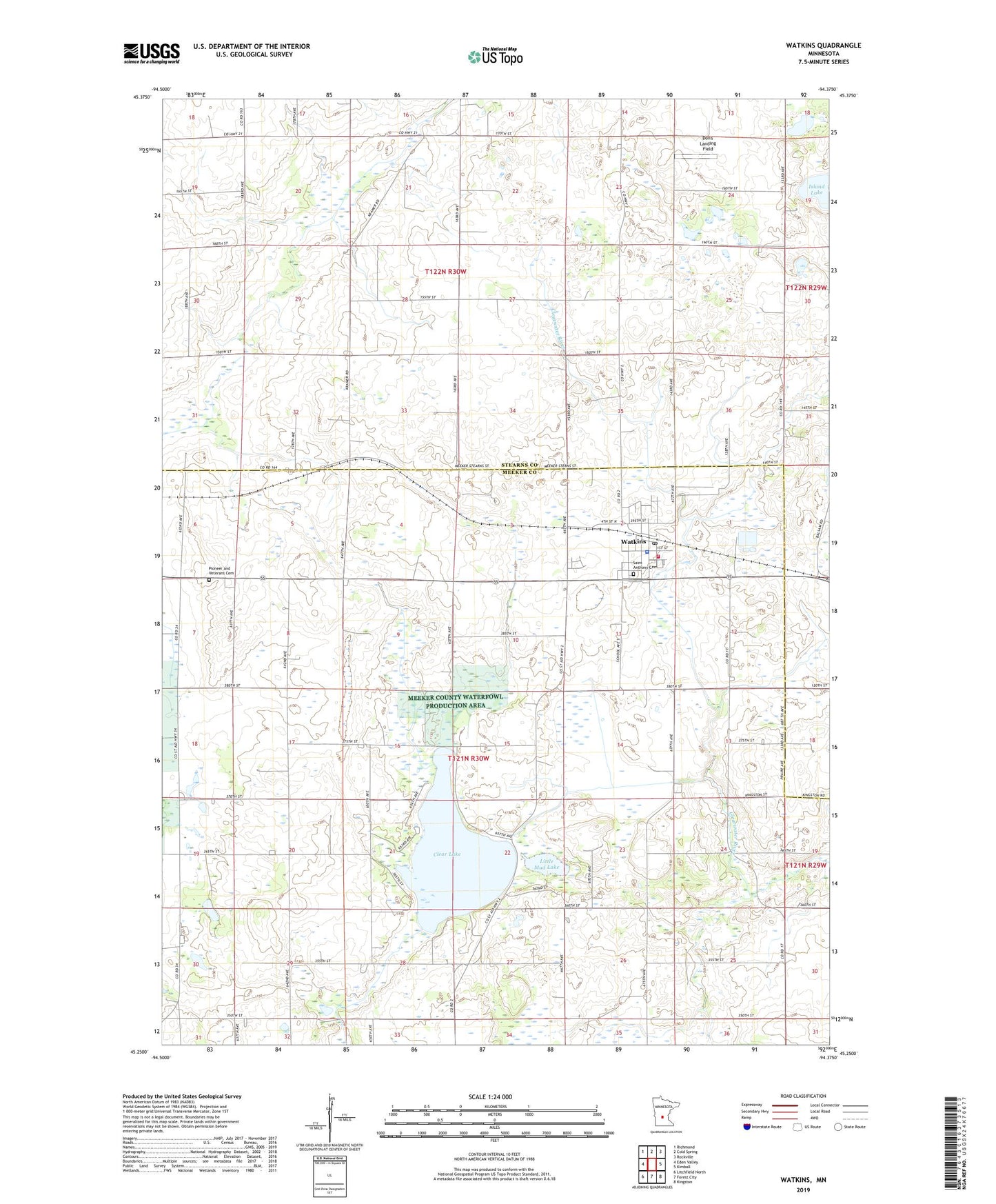
2022 topographic map quadrangle Watkins in the state of Minnesota. Scale: 1:24000. Based on the newly updated USGS 7.5' US Topo map series, this map is in the following counties: Meeker, Stearns. The map contains contour data, water features, and other items you are used to seeing on USGS maps, but also has updated roads and other features. This is the next generation of topographic maps. Printed on high-quality waterproof paper with UV fade-resistant inks.
Quads adjacent to this one:
West: Eden Valley
Northwest: Richmond
North: Cold Spring
Northeast: Rockville
East: Kimball
Southeast: Kingston
South: Forest City
Southwest: Litchfield North
This map covers the same area as the classic USGS quad with code o45094c4.
Contains the following named places: Church of Saint Anthony, City of Watkins, Clear Creek Campground, Clear Lake, County Ditch Number Fortyfour, County Ditch Number Twenty, Don's Landing Field, Hilltop Good Samaritan Center, Little Mud Lake, Pioneer and Veterans Cemetery, Saint Anthony Cemetery, Saint Anthony School, School Number 1103, Sportsmen Park, Township of Forest Prairie, Township of Luxemburg, Watkins, Watkins Ambulance Service, Watkins Community Fire Department, Watkins Elementary School, Watkins Fire Department, Watkins Medical Clinic, Watkins Mobile Home Park, Watkins Police Department, Watkins Post Office, Watkins Village Hall, ZIP Code: 55389