MyTopo
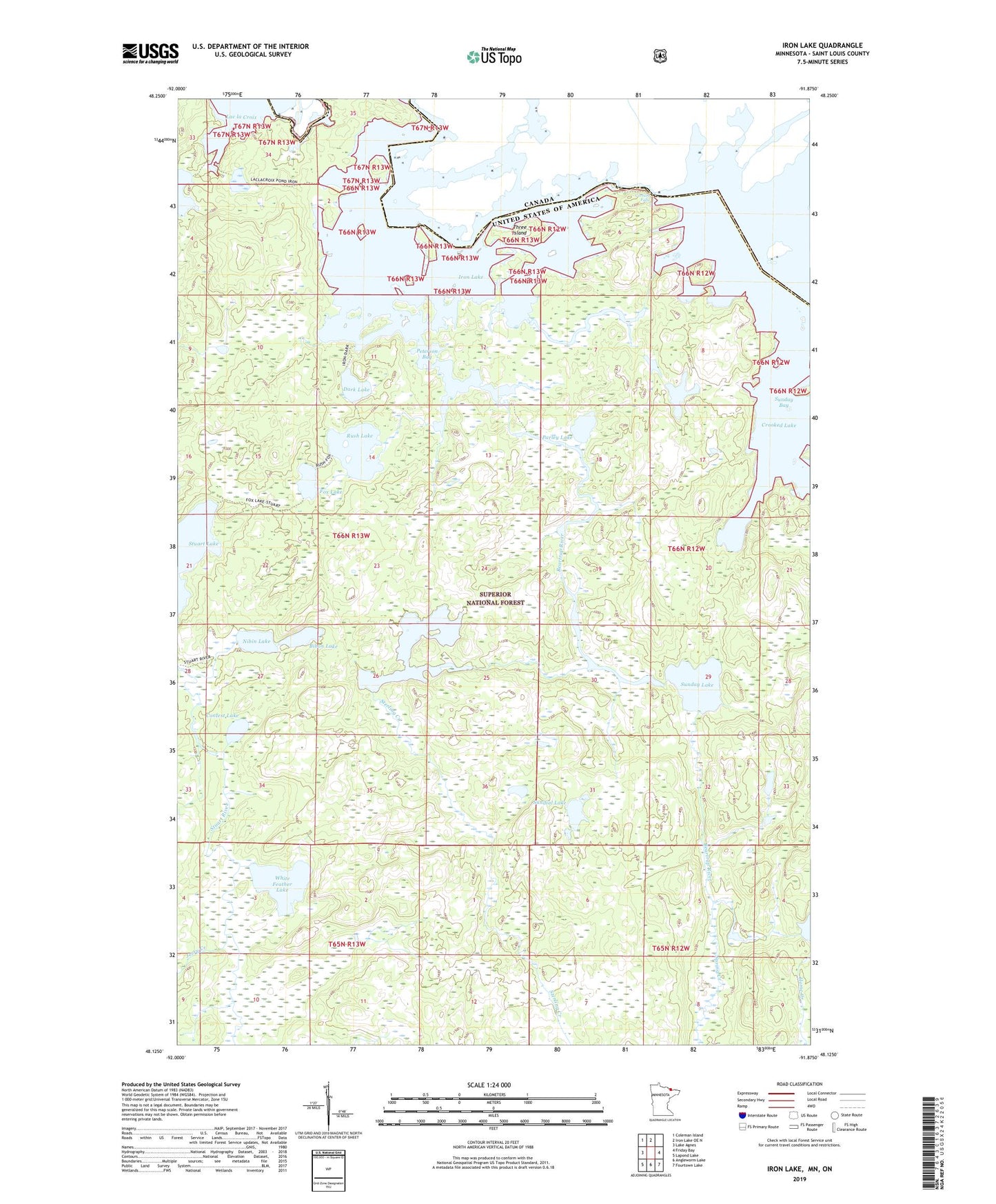
Iron Lake Minnesota US Topo Map
Couldn't load pickup availability
Also explore the Iron Lake Forest Service Topo of this same quad for updated USFS data
2022 topographic map quadrangle Iron Lake in the state of Minnesota. Scale: 1:24000. Based on the newly updated USGS 7.5' US Topo map series, this map is in the following counties: St. Louis. The map contains contour data, water features, and other items you are used to seeing on USGS maps, but also has updated roads and other features. This is the next generation of topographic maps. Printed on high-quality waterproof paper with UV fade-resistant inks.
Quads adjacent to this one:
West: Lake Agnes
Northwest: Coleman Island
North: Iron Lake OE N
East: Friday Bay
Southeast: Fourtown Lake
South: Angleworm Lake
Southwest: Lapond Lake
This map covers the same area as the classic USGS quad with code o48091b8.
Contains the following named places: Beartrap River, Bibon Lake, Bottle River, Contest Lake, Curtain Falls, Dark Lake, Fox Lake, Iron Lake, Jerry Creek, Nibin Lake, Parley Lake, Peterson Bay, Rush Lake, Spring Creek, Sterling Creek, Sterling Lake, Sunday Lake, Sundial Lake, Three Island, White Feather Lake