MyTopo
Delavan Minnesota US Topo Map
Couldn't load pickup availability
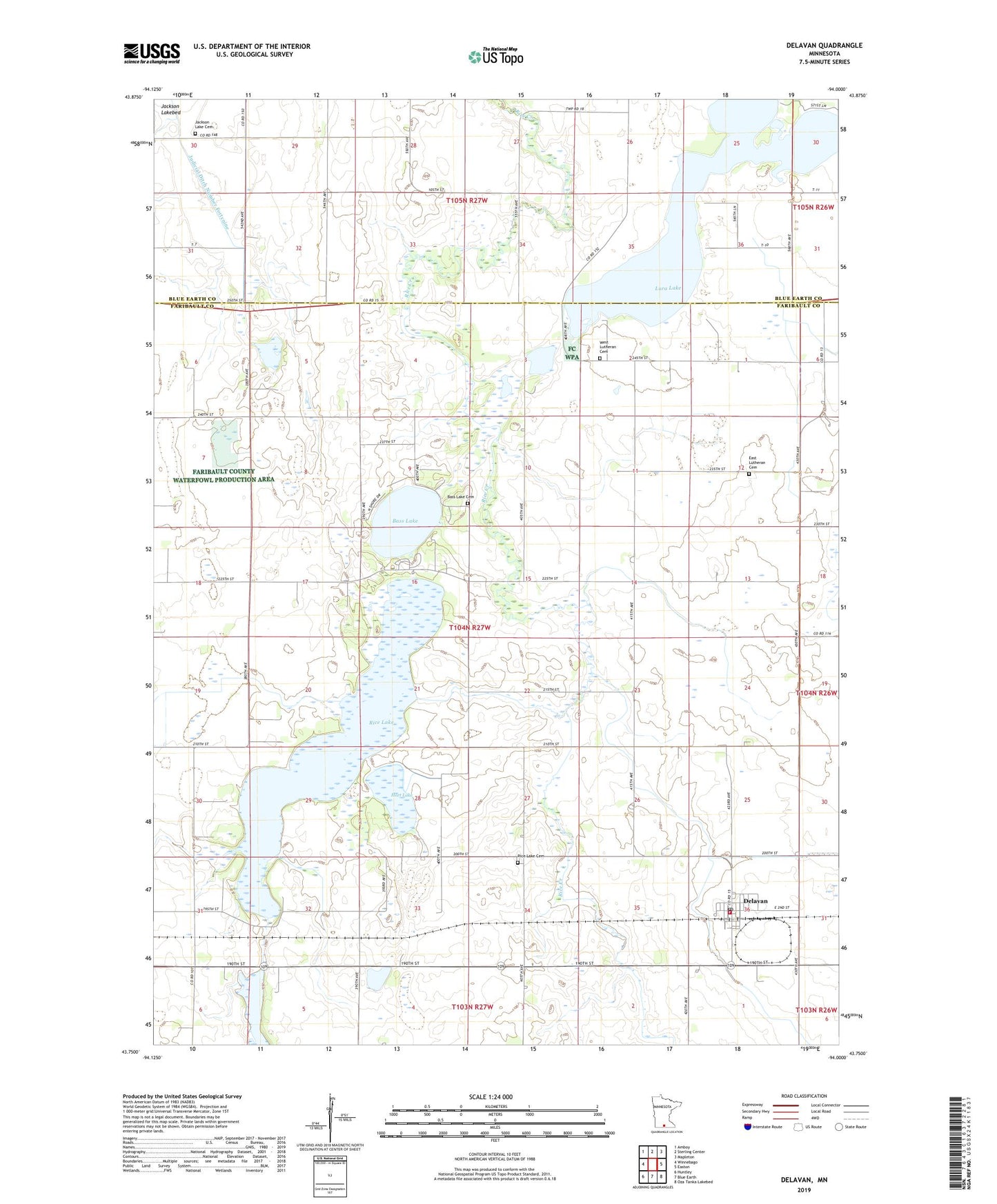
2022 topographic map quadrangle Delavan in the state of Minnesota. Scale: 1:24000. Based on the newly updated USGS 7.5' US Topo map series, this map is in the following counties: Faribault, Blue Earth. The map contains contour data, water features, and other items you are used to seeing on USGS maps, but also has updated roads and other features. This is the next generation of topographic maps. Printed on high-quality waterproof paper with UV fade-resistant inks.
Quads adjacent to this one:
West: Winnebago
Northwest: Amboy
North: Sterling Center
Northeast: Mapleton
East: Easton
Southeast: Oza Tanka Lakebed
South: Blue Earth
Southwest: Huntley
This map covers the same area as the classic USGS quad with code o43094g1.
Contains the following named places: Bass Lake, Bass Lake Cemetery, City of Delavan, County Ditch Number Nine, Daly Park, Daly Park Campground, Delavan, Delavan Catholic Church, Delavan Post Office, Delavan Village Hall, Delavan Volunteer Fire Department, East Church, East Lutheran Cemetery, Faith Lutheran Church, Hart Lake, Jackson Lake Cemetery, Judicial Ditch Number One, Judicial Ditch Number Ten, Lura Lake, Rice Lake, Rice Lake Cemetery, Rice Lake Dam, Township of Delavan, United Methodist Church, Vernon Finseth Dam, West Lutheran Cemetery, ZIP Code: 56023