MyTopo
Amboy Minnesota US Topo Map
Couldn't load pickup availability
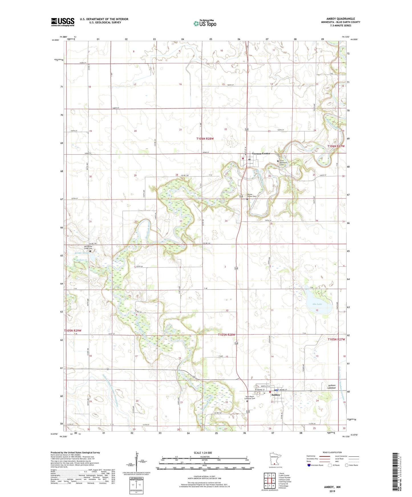
2022 topographic map quadrangle Amboy in the state of Minnesota. Scale: 1:24000. Based on the newly updated USGS 7.5' US Topo map series, this map is in the following counties: Blue Earth. The map contains contour data, water features, and other items you are used to seeing on USGS maps, but also has updated roads and other features. This is the next generation of topographic maps. Printed on high-quality waterproof paper with UV fade-resistant inks.
Quads adjacent to this one:
West: Willow Creek
Northwest: Perth
North: Lake Crystal
Northeast: Good Thunder
East: Sterling Center
Southeast: Delavan
South: Winnebago
Southwest: Truman SE
This map covers the same area as the classic USGS quad with code o43094h2.
Contains the following named places: Amboy, Amboy - Vernon Center Police Department, Amboy Post Office, Amboy Volunteer Fire Department, City of Amboy, City of Vernon Center, County Ditch Number Seventyeight, Grace United Methodist Church, Ida Lake, Jackson Lake Lutheran Church, Judicial Ditch Number Twentyfour, Old Willow Creek Cemetery, Presbyterian Church, Reinke Slough, Saint Matthew's Catholic Church, Saint Matthews Cemetery, Saint Paul Evangelical Lutheran Cemetery, Saint Paul's Lutheran Church, Saint Peter's Lutheran Church, Township of Shelby, Township of Vernon Center, United Methodist Church, Vernon Center, Vernon Center Cemetery, Vernon Center City Hall, Vernon Center Intermediate School, Vernon Center Post Office, Vernon Center Volunteer Fire Department, West Middle School, Willow Creek, ZIP Codes: 56010, 56090