MyTopo
Ashby Minnesota US Topo Map
Couldn't load pickup availability
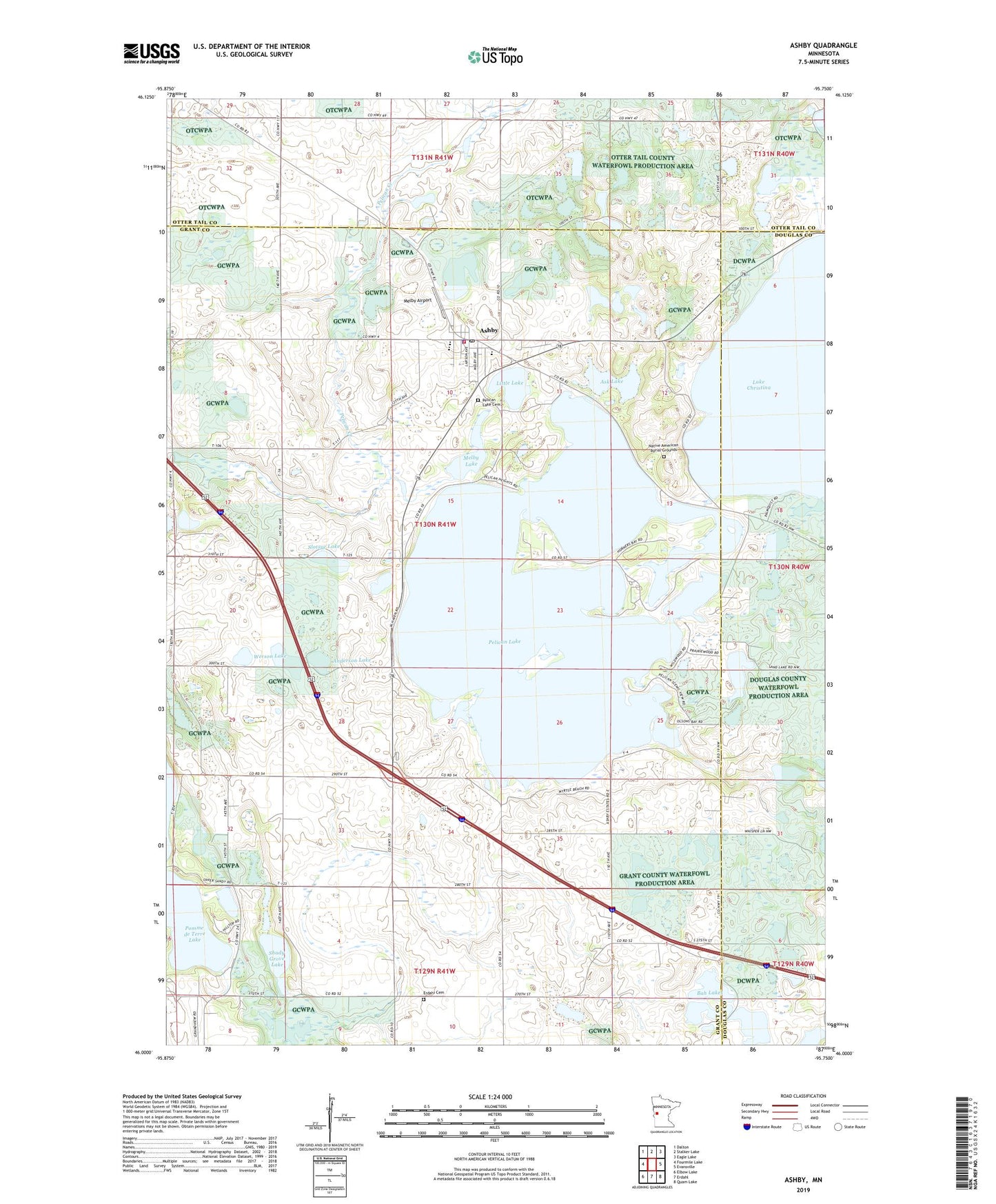
2022 topographic map quadrangle Ashby in the state of Minnesota. Scale: 1:24000. Based on the newly updated USGS 7.5' US Topo map series, this map is in the following counties: Grant, Otter Tail, Douglas. The map contains contour data, water features, and other items you are used to seeing on USGS maps, but also has updated roads and other features. This is the next generation of topographic maps. Printed on high-quality waterproof paper with UV fade-resistant inks.
Quads adjacent to this one:
West: Fourmile Lake
Northwest: Dalton
North: Stalker Lake
Northeast: Eagle Lake
East: Evansville
Southeast: Quam Lake
South: Erdahl
Southwest: Elbow Lake
This map covers the same area as the classic USGS quad with code o46095a7.
Contains the following named places: Anderson Lake, Ashby, Ashby Clinic, Ashby Fire Department and Ambulance Service, Ashby Information and Visitor Center, Ashby Police Department, Ashby Post Office, Ashby Public School, Ashby Resort and Campground, Ashby Village Hall, Ask Lake, Bah Lakes, Carp Dam, City of Ashby, Erdahl Lutheran Cemetery, First Presbyterian Church, Grace Lutheran Church, Indian Mounds Resort and Campgrounds, Little Lake, Melby Airport, Melby Lake, Native American Burial Grounds, Peace Lutheran Church, Pelican Lake, Pelican Lake Cemetery, Pelican Lake Health Care Center, Pelican Lake Lutheran Church, School Number 19, School Number 3, School Number 6, School Number 7, Shady Grove Lake, Shady Lawn Resort and Campground, Slotsye Lake, Sundowner Campground, Township of Pelican Lake, Werson Lake, ZIP Code: 56309