MyTopo
Echo Minnesota US Topo Map
Couldn't load pickup availability
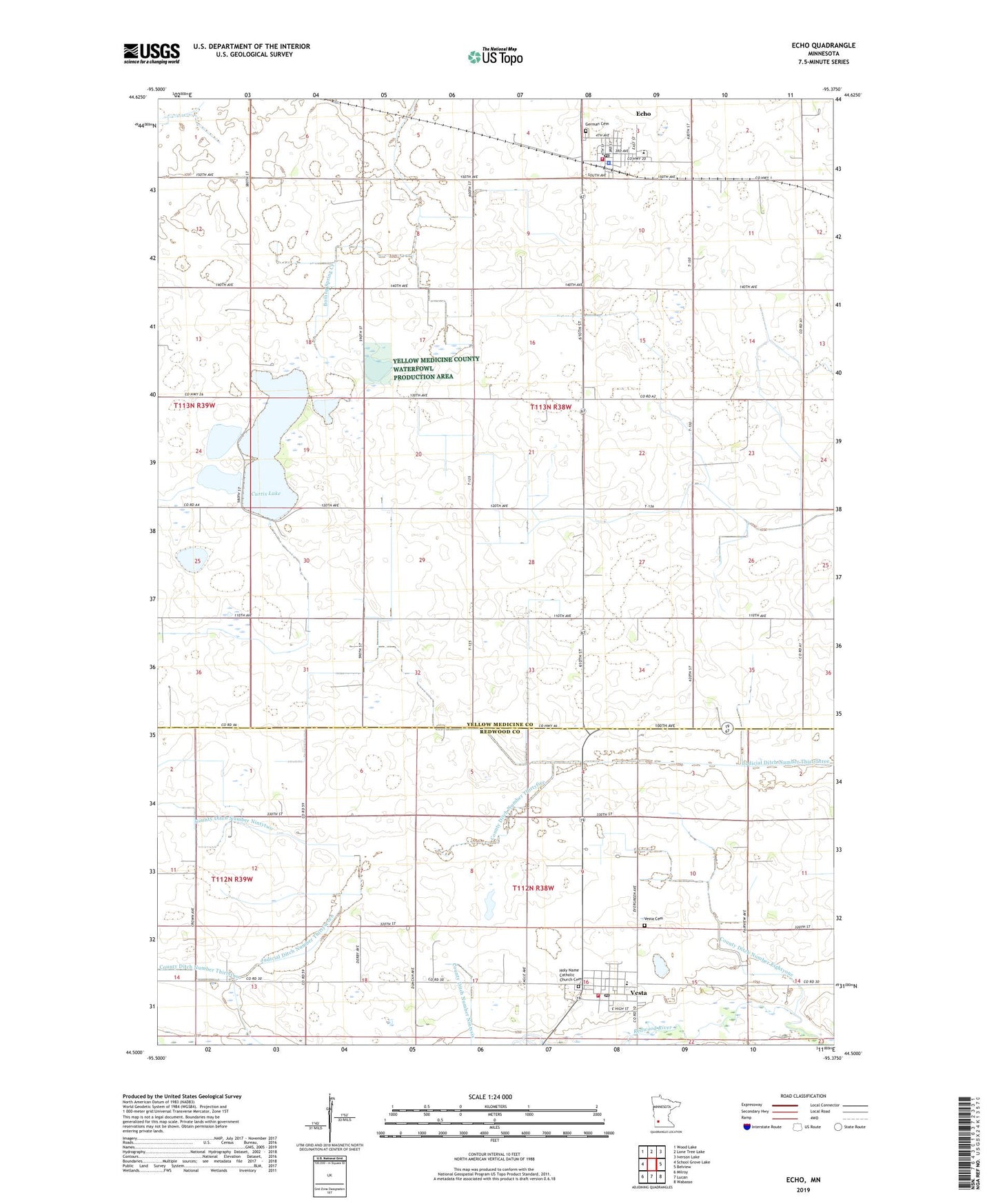
2019 topographic map quadrangle Echo in the state of Minnesota. Scale: 1:24000. Based on the newly updated USGS 7.5' US Topo map series, this map is in the following counties: Yellow Medicine, Redwood. The map contains contour data, water features, and other items you are used to seeing on USGS maps, but also has updated roads and other features. This is the next generation of topographic maps. Printed on high-quality waterproof paper with UV fade-resistant inks.
Quads adjacent to this one:
West: School Grove Lake
Northwest: Wood Lake
North: Lone Tree Lake
Northeast: Iverson Lake
East: Belview
Southeast: Wabasso
South: Lucan
Southwest: Milroy
Contains the following named places: American Lutheran Church, City of Echo, City of Vesta, County Ditch Number Eightyone, County Ditch Number Ninetysix, County Ditch Number Ninetytwo, County Ditch Number Thirtyfive, County Ditch Number Thirtytwo, Curtis Lake, Echo, Echo Alliance Church, Echo Fire Hall, Echo Police Department, Echo Post Office, Echo Volunteer Fire Department, German Cemetery, Holy Name Catholic Church Cemetery, Judicial Ditch Number Thirtyseven, Peace Lutheran Church, Posen State Wildlife Management Area, Saint John Lutheran Church, Schmidt Private Airport, Township of Echo, Vesta, Vesta Cemetery, Vesta Fire Department, Vesta Post Office, Vesta Town Hall, ZIP Codes: 56237, 56292