MyTopo
New Richland Minnesota US Topo Map
Couldn't load pickup availability
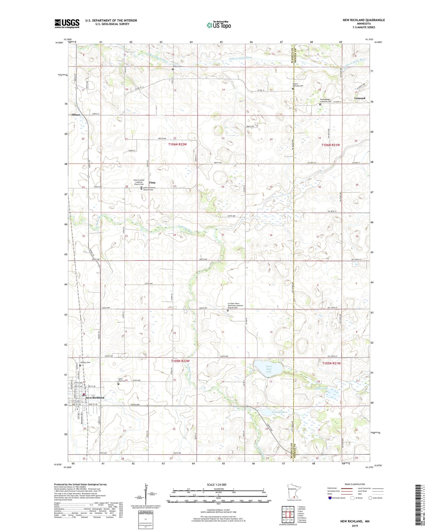
2022 topographic map quadrangle New Richland in the state of Minnesota. Scale: 1:24000. Based on the newly updated USGS 7.5' US Topo map series, this map is in the following counties: Waseca, Steele. The map contains contour data, water features, and other items you are used to seeing on USGS maps, but also has updated roads and other features. This is the next generation of topographic maps. Printed on high-quality waterproof paper with UV fade-resistant inks.
Quads adjacent to this one:
West: Otisco
Northwest: Waseca
North: Meriden
Northeast: Saco
East: Hope
Southeast: Ellendale
South: Hartland
Southwest: Freeborn
This map covers the same area as the classic USGS quad with code o43093h4.
Contains the following named places: Calvary Cemetery, Church of All Saints, City of New Richland, County Ditch Number Thirtythree, County Ditch Number Twentyseven, First Congregational Church, Fosilen Lake, Johnson Oakside Orchard, Judicial Ditch Number Five, Le Sueur River American Lutheran Church Cemetery, Le Sueur River Church, Lemond, Lemond Post Office, New Richland, New Richland Ambulance, New Richland Care Center, New Richland City Hall, New Richland Clinic, New Richland Fire Department, New Richland Police Department, New Richland Post Office, New Richland Public Library, New Richland Public School, Otisco - Lemond Cemetery, Otisco Cemetery, Pontoppidan Lutheran Cemetery, Pontoppidan Lutheran Church, Reese Lake, Saint Olaf Cemetery, Saint Olaf Lake, Saint Olaf Lake Dam, Saint Olaf Lake Park, Saint Peter's Lutheran Church, School Number 2137, Teal State Wildlife Management Area, Township of New Richland, Township of Otisco, Trinity Lutheran Church, Vista, Vista Covenant Church Cemetery, Vista Evangelical Covenant Church, Vista Lutheran Church, Vista Post Office, Vista Swedish Lutheran Church Cemetery