MyTopo
Hanska Minnesota US Topo Map
Couldn't load pickup availability
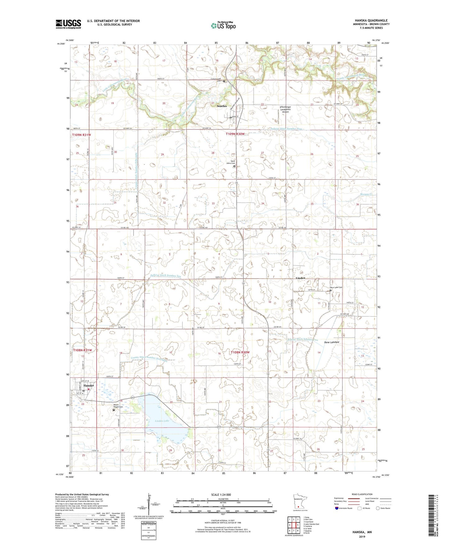
2022 topographic map quadrangle Hanska in the state of Minnesota. Scale: 1:24000. Based on the newly updated USGS 7.5' US Topo map series, this map is in the following counties: Brown. The map contains contour data, water features, and other items you are used to seeing on USGS maps, but also has updated roads and other features. This is the next generation of topographic maps. Printed on high-quality waterproof paper with UV fade-resistant inks.
Quads adjacent to this one:
West: Lake Hanska East
Northwest: Essig
North: New Ulm
Northeast: Courtland
East: Cambria
Southeast: Perth
South: Madelia
Southwest: La Salle
This map covers the same area as the classic USGS quad with code o44094b4.
Contains the following named places: City of Hanska, Cottonwood Cemetery, County Ditch Number Fiftyeight, County Ditch Number Sixtyseven, County Ditch Number Sixtythree, County Ditch Number Thirtyfour, County Ditch Number Two, Dane Lakebed, Effenberger Landeplatz Airport, Hanska, Hanska Community Library, Hanska Community School, Hanska Fire Department, Hanska Post Office, Judicial Ditch Number Nine, Judicial Ditch Number Six, Judicial Ditch Number Ten, Linden, Linden Lake, Linden Post Office, Mount Pisgah Cemetery, Nora Church, Rice Lake Cemetery, Saint Johns Cemetery, Searles, Searles Census Designated Place, Searles Post Office, Township of Cottonwood, Township of Linden, Zion Lutheran Church