MyTopo
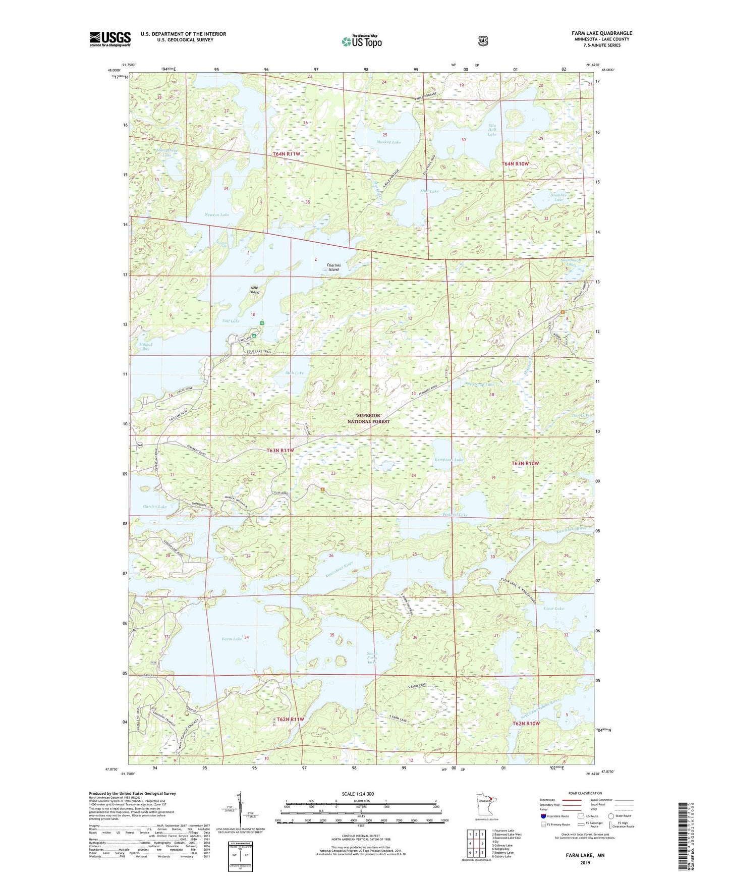
Farm Lake Minnesota US Topo Map
Couldn't load pickup availability
Also explore the Farm Lake Forest Service Topo of this same quad for updated USFS data
2022 topographic map quadrangle Farm Lake in the state of Minnesota. Scale: 1:24000. Based on the newly updated USGS 7.5' US Topo map series, this map is in the following counties: Lake. The map contains contour data, water features, and other items you are used to seeing on USGS maps, but also has updated roads and other features. This is the next generation of topographic maps. Printed on high-quality waterproof paper with UV fade-resistant inks.
Quads adjacent to this one:
West: Ely
Northwest: Fourtown Lake
North: Basswood Lake West
Northeast: Basswood Lake East
East: Ojibway Lake
Southeast: Gabbro Lake
South: Bogberry Lake
Southwest: Kangas Bay
This map covers the same area as the classic USGS quad with code o47091h6.
Contains the following named places: Charlies Island, Clear Lake, Ella Hall Lake, Eskwagama Lake, Fall Lake, Fall Lake Campground, Farm Lake, Garden Lake, Kawishiwi River, Kemptons Lake, Mile Island, Mud Lake, Mulkuk Bay, Muskeg Lake, Newton Falls, Newton Lake, Pea Soup Lake, Pickerel Lake, Slumber Lake, Sourdough Lake, South Farm Lake, Stub Lake, Superior Forest Lodge and Campground, Thirtythree Lake, Timber Trail Resort and Campgrounds, ZIP Code: 55731