MyTopo
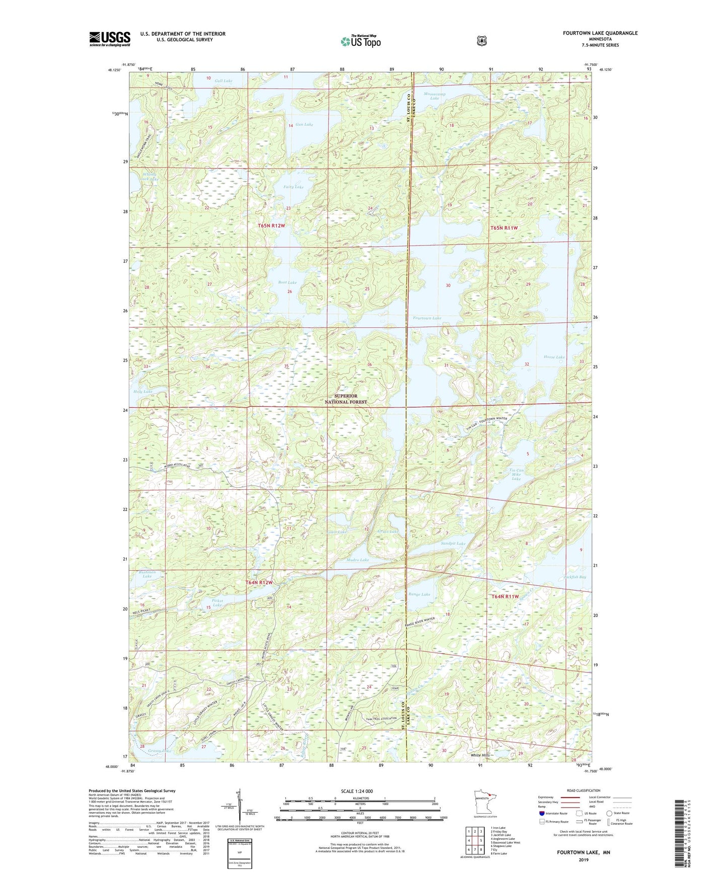
Fourtown Lake Minnesota US Topo Map
Couldn't load pickup availability
Also explore the Fourtown Lake Forest Service Topo of this same quad for updated USFS data
2022 topographic map quadrangle Fourtown Lake in the state of Minnesota. Scale: 1:24000. Based on the newly updated USGS 7.5' US Topo map series, this map is in the following counties: St. Louis, Lake. The map contains contour data, water features, and other items you are used to seeing on USGS maps, but also has updated roads and other features. This is the next generation of topographic maps. Printed on high-quality waterproof paper with UV fade-resistant inks.
Quads adjacent to this one:
West: Angleworm Lake
Northwest: Iron Lake
North: Friday Bay
Northeast: Jackfish Lake
East: Basswood Lake West
Southeast: Farm Lake
South: Ely
Southwest: Shagawa Lake
This map covers the same area as the classic USGS quad with code o48091a7.
Contains the following named places: Alruss Lake, Boot Lake, Bushmen Lake, Crooked Lake Trail, Fairy Lake, Fourtown Lake, Grassy Lake, Gull Lake, Gun Lake, Holy Lake, Home Lake, Horse Lake, Louis Lake, Moosecamp Lake, Mudro Lake, No-see-um Lake, Picket Lake, Range Lake, Range River, Sandpit Lake, Spawn Creek, Tick Lake, Tin Can Mike Lake, Unorganized Territory of Angleworm Lake, Whisky Jack Lake