MyTopo
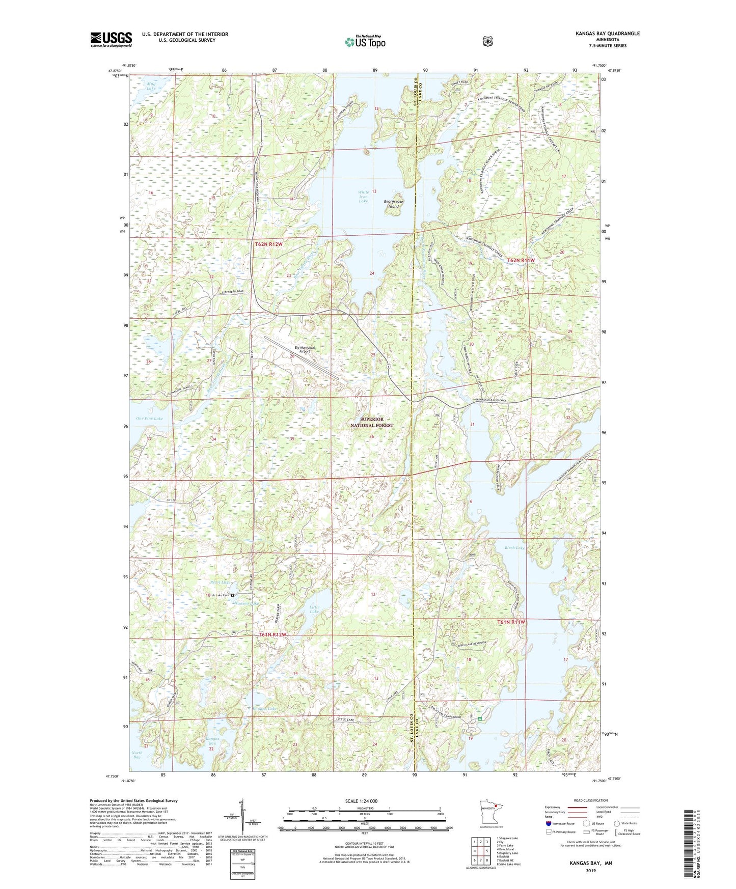
Kangas Bay Minnesota US Topo Map
Couldn't load pickup availability
Also explore the Kangas Bay Forest Service Topo of this same quad for updated USFS data
2022 topographic map quadrangle Kangas Bay in the state of Minnesota. Scale: 1:24000. Based on the newly updated USGS 7.5' US Topo map series, this map is in the following counties: St. Louis, Lake. The map contains contour data, water features, and other items you are used to seeing on USGS maps, but also has updated roads and other features. This is the next generation of topographic maps. Printed on high-quality waterproof paper with UV fade-resistant inks.
Quads adjacent to this one:
West: Bear Island
Northwest: Shagawa Lake
North: Ely
Northeast: Farm Lake
East: Bogberry Lake
Southeast: Slate Lake West
South: Babbitt NE
Southwest: Babbitt
This map covers the same area as the classic USGS quad with code o47091g7.
Contains the following named places: Bear Island River, Bear Island State Forest, Beargrease Island, Birch Lake Campground, Birch Lake Cemetery, Birch Lake Dam, Birch Lake Dam Rest Area, Birch River, Ely Municipal Airport, Hanson Lake, Kangas Bay, Kangas Creek, Kangas Lake, Keeley Creek, Little Lake, Mud Lake, North Bay, Pearl Lake, South Kawishiwi River, White Iron Lake