MyTopo
Florian Minnesota US Topo Map
Couldn't load pickup availability
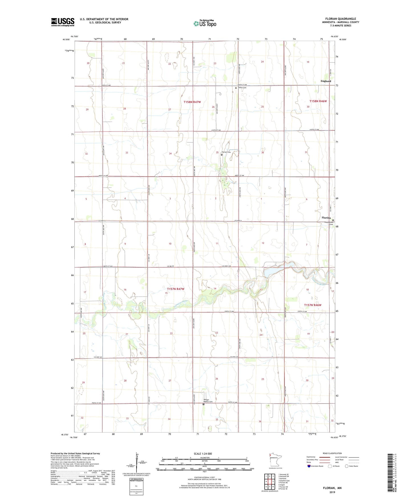
2022 topographic map quadrangle Florian in the state of Minnesota. Scale: 1:24000. Based on the newly updated USGS 7.5' US Topo map series, this map is in the following counties: Marshall. The map contains contour data, water features, and other items you are used to seeing on USGS maps, but also has updated roads and other features. This is the next generation of topographic maps. Printed on high-quality waterproof paper with UV fade-resistant inks.
Quads adjacent to this one:
West: Stephen East
Northwest: Kennedy SE
North: Karlstad SW
Northeast: Karlstad
East: Florian NE
Southeast: Florian SE
South: Florian SW
Southwest: Argyle
This map covers the same area as the classic USGS quad with code o48096d6.
Contains the following named places: Apple Post Office, Assumption Cemetery, Bend Post Office, Englund, Englund Post Office, Florian, Florian Cemetery, Florian County Park, Florian Post Office, Marshall County Florian Park Campground, Salem Cemetery, Salem Church, School Number 50, School Number 55, Tamarac River R1 Structure Dam, Township of Wanger, Wanger Baptist Cemetery, Wanger Church