MyTopo
Karlstad Minnesota US Topo Map
Couldn't load pickup availability
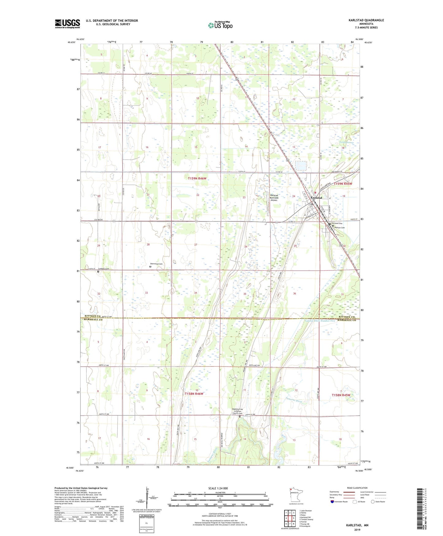
2022 topographic map quadrangle Karlstad in the state of Minnesota. Scale: 1:24000. Based on the newly updated USGS 7.5' US Topo map series, this map is in the following counties: Kittson, Marshall. The map contains contour data, water features, and other items you are used to seeing on USGS maps, but also has updated roads and other features. This is the next generation of topographic maps. Printed on high-quality waterproof paper with UV fade-resistant inks.
Quads adjacent to this one:
West: Karlstad SW
Northwest: Lake Bronson
North: Halma
Northeast: Pelan
East: Twistal Swamp
Southeast: Strandquist
South: Florian NE
Southwest: Florian
This map covers the same area as the classic USGS quad with code o48096e5.
Contains the following named places: Altru Clinic, Baptist Church, Beaton Post Office, City of Karlstad, County Ditch Number Ten, Deerwood, Deerwood Cemetery, Deerwood Church, Fir Post Office, First Lutheran Church, Green Lea Mobile Home Park, Hegland Church, Hegland Free Lutheran Church Cemetery, Heritage Christian School, Karlstad, Karlstad Cemetery, Karlstad Country Golf Club, Karlstad Gospel Tabernacle Church, Karlstad Municipal Airport, Karlstad Municipal Moose Park Campground, Karlstad Post Office, Karlstad Volunteer Fire Department, Kittson Memorial Nursing Center, Lundeby Cemetery, Pearson Cemetery, Resurrection Lutheran Church, Saint Edward's Catholic Church, Seventh Day Adventist Church, State Ditch Number Ninty, Sundby Mobile Home Court, Township of Deerwood, Township of Nelson Park, Tri - County Emergency Medical Services District, Tri-County High School