MyTopo
Karlstad SW Minnesota US Topo Map
Couldn't load pickup availability
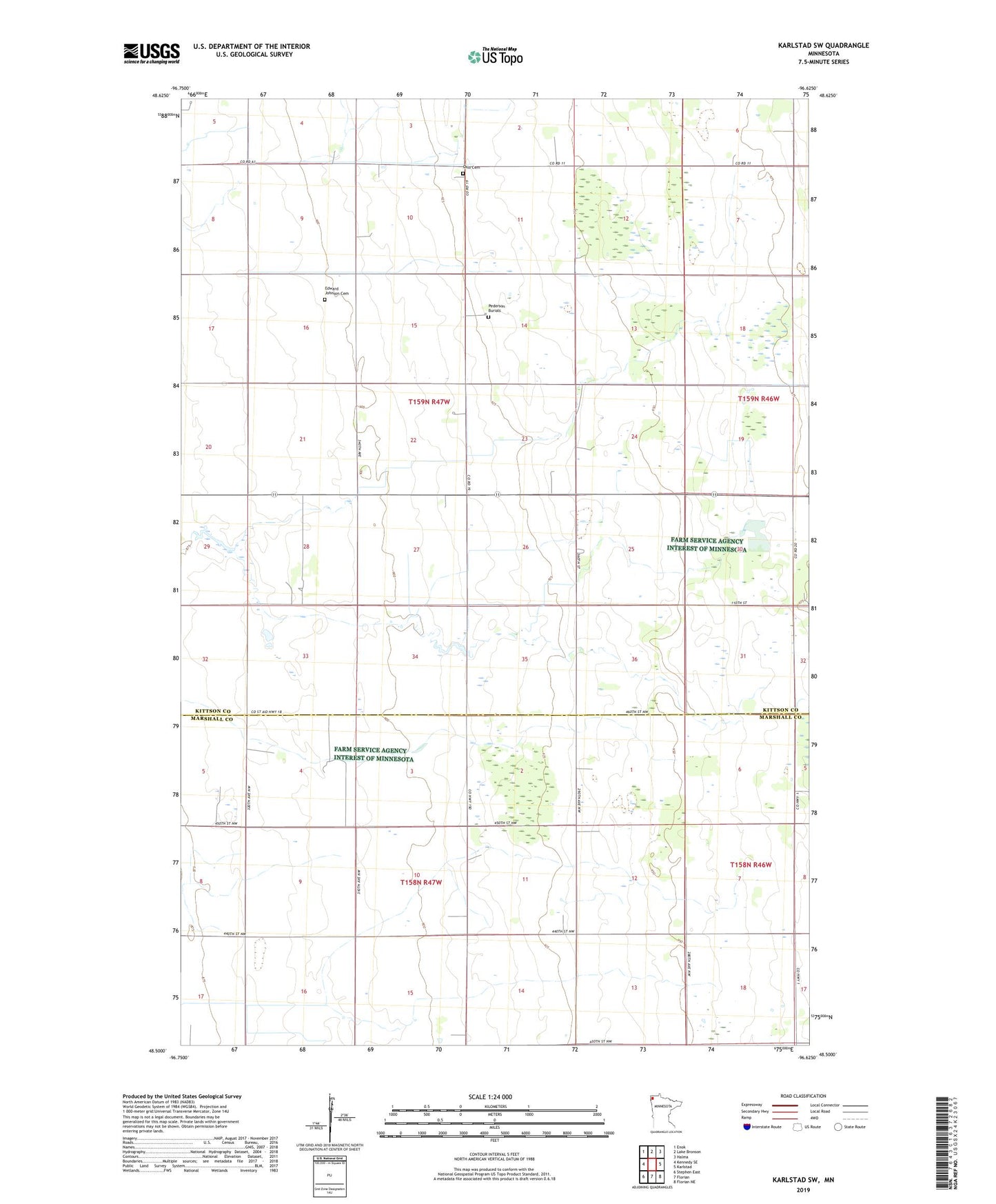
2022 topographic map quadrangle Karlstad SW in the state of Minnesota. Scale: 1:24000. Based on the newly updated USGS 7.5' US Topo map series, this map is in the following counties: Kittson, Marshall. The map contains contour data, water features, and other items you are used to seeing on USGS maps, but also has updated roads and other features. This is the next generation of topographic maps. Printed on high-quality waterproof paper with UV fade-resistant inks.
Quads adjacent to this one:
West: Kennedy SE
Northwest: Enok
North: Lake Bronson
Northeast: Halma
East: Karlstad
Southeast: Florian NE
South: Florian
Southwest: Stephen East
This map covers the same area as the classic USGS quad with code o48096e6.
Contains the following named places: Benson School, Bridgeport Post Office, Edward Johnson Cemetery, Oslo Cemetery, Oslo Church, Pederson Burials, Township of Augsburg, Township of Spring Brook