MyTopo
Cherry Grove Minnesota US Topo Map
Couldn't load pickup availability
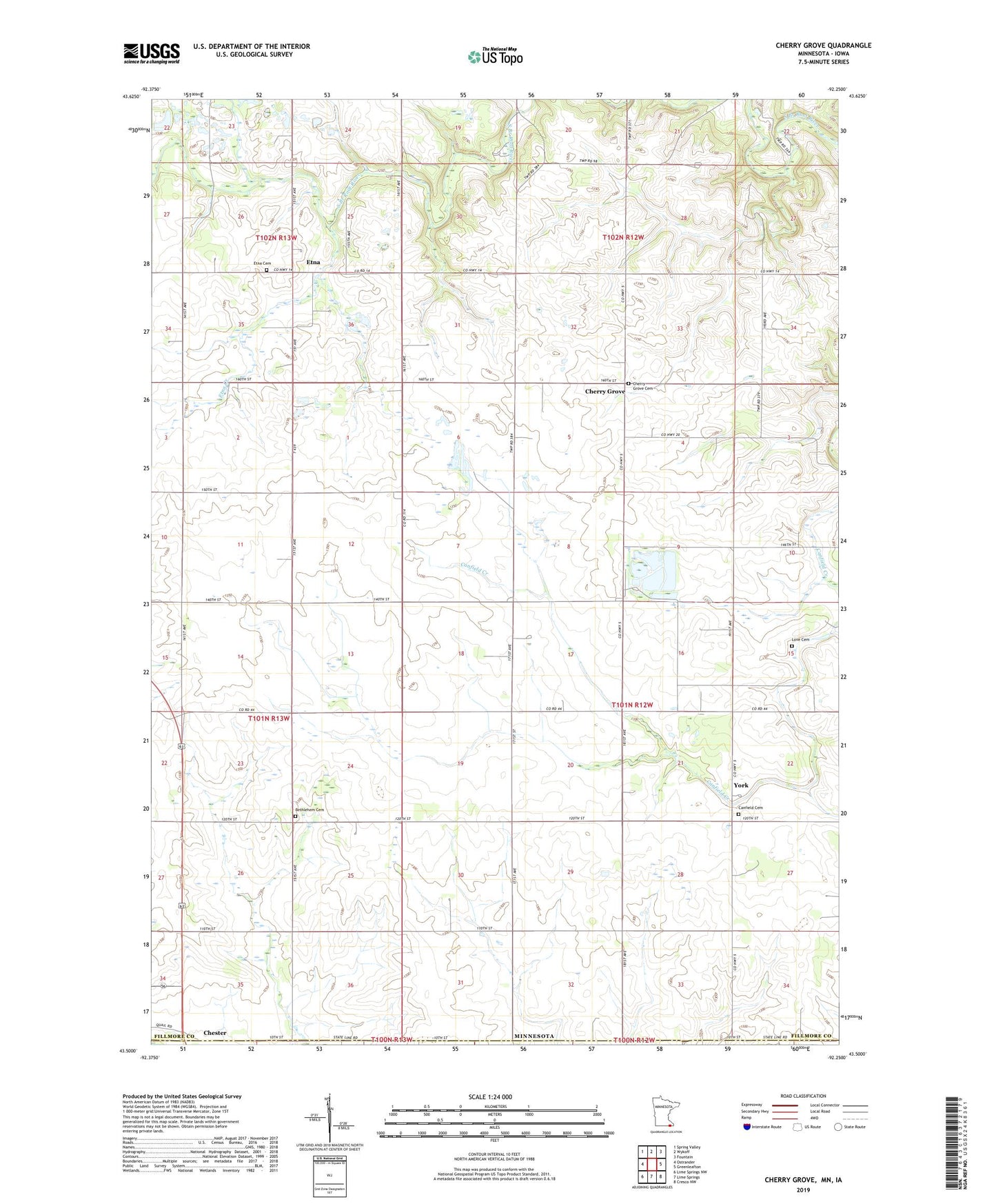
2023 topographic map quadrangle Cherry Grove in the state of Minnesota. Scale: 1:24000. Based on the newly updated USGS 7.5' US Topo map series, this map is in the following counties: Fillmore, Howard. The map contains contour data, water features, and other items you are used to seeing on USGS maps, but also has updated roads and other features. This is the next generation of topographic maps. Printed on high-quality waterproof paper with UV fade-resistant inks.
Quads adjacent to this one:
West: Ostrander
Northwest: Spring Valley
North: Wykoff
Northeast: Fountain
East: Greenleafton
Southeast: Cresco NW
South: Lime Springs
Southwest: Lime Springs NW
This map covers the same area as the classic USGS quad with code o43092e3.
Contains the following named places: Bethlehem Cemetery, Canfield Cemetery, Cherry Grove, Cherry Grove Cemetery, Cherry Grove Post Office, Cherry Grove United Methodist Church, Etna, Etna Cemetery, Etna Creek, Etna Post Office, Love Cemetery, Mystery Cave Historical Marker, Pietenpol Landing Field, School Number 525, State Line Wayside Park, Township of York, York, York Post Office