MyTopo
Greenleafton Minnesota US Topo Map
Couldn't load pickup availability
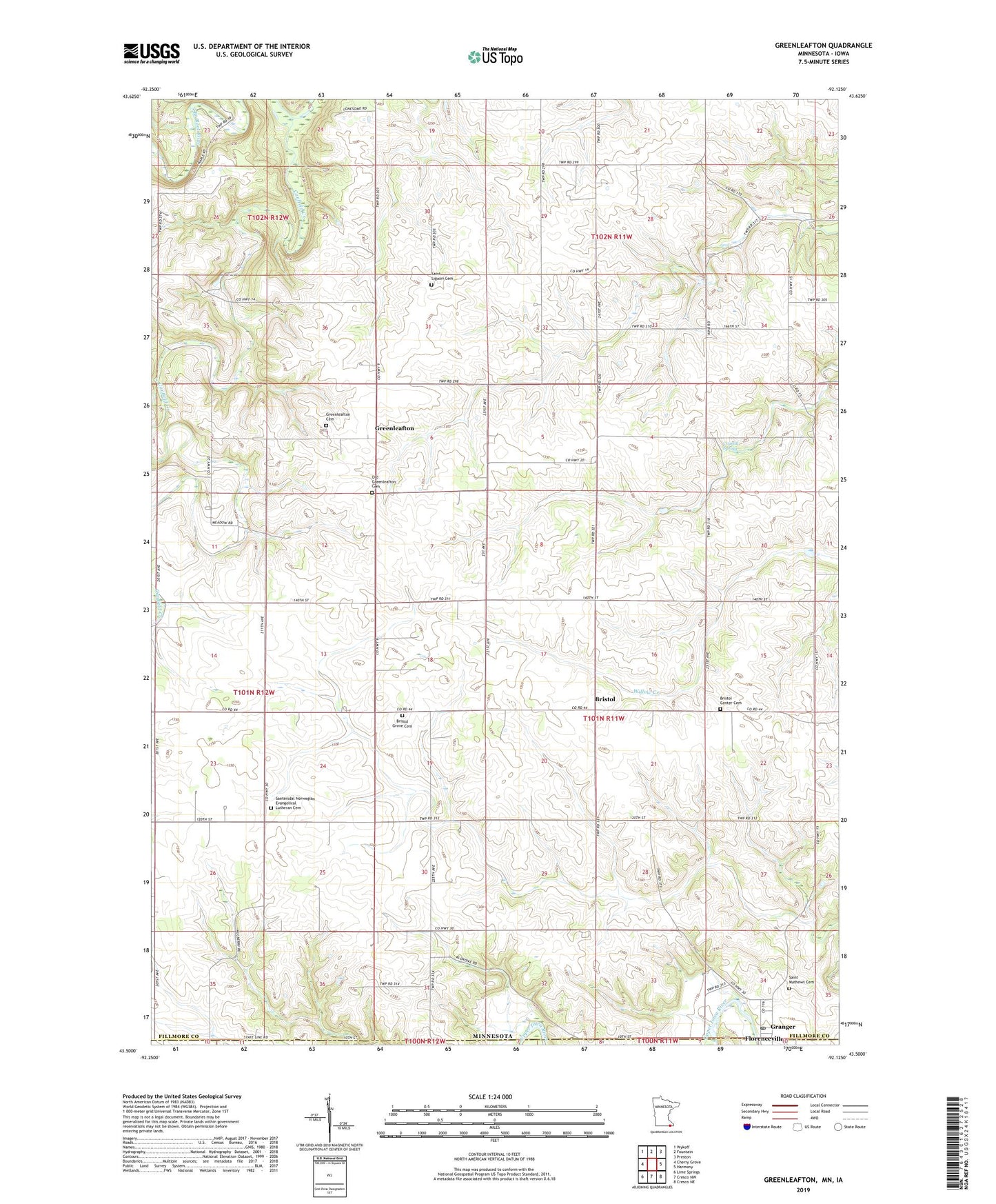
2022 topographic map quadrangle Greenleafton in the state of Minnesota. Scale: 1:24000. Based on the newly updated USGS 7.5' US Topo map series, this map is in the following counties: Fillmore, Howard. The map contains contour data, water features, and other items you are used to seeing on USGS maps, but also has updated roads and other features. This is the next generation of topographic maps. Printed on high-quality waterproof paper with UV fade-resistant inks.
Quads adjacent to this one:
West: Cherry Grove
Northwest: Wykoff
North: Fountain
Northeast: Preston
East: Harmony
Southeast: Cresco NE
South: Cresco NW
Southwest: Lime Springs
This map covers the same area as the classic USGS quad with code o43092e2.
Contains the following named places: Bristol, Bristol Center Cemetery, Bristol Grove Cemetery, Bristol Post Office, Canfield Creek, Church of the Brethren, Crystal Spring, East Willow Creek Dam, Granger, Granger Post Office, Greenleafton, Greenleafton Cemetery, Greenleafton Post Office, Greenleafton Reformed Church, Hanning Brothers Group Pond Dam, Old Greenleafton Cemetery, Saetersdal Norwegian Evangelical Lutheran Cemetery, Saetersdale Church, Saint Liguori Cemetery, Saint Mathews Cemetery, Saint Matthew's Lutheran Church, Township of Bristol, ZIP Code: 55965