MyTopo
Slayton Minnesota US Topo Map
Couldn't load pickup availability
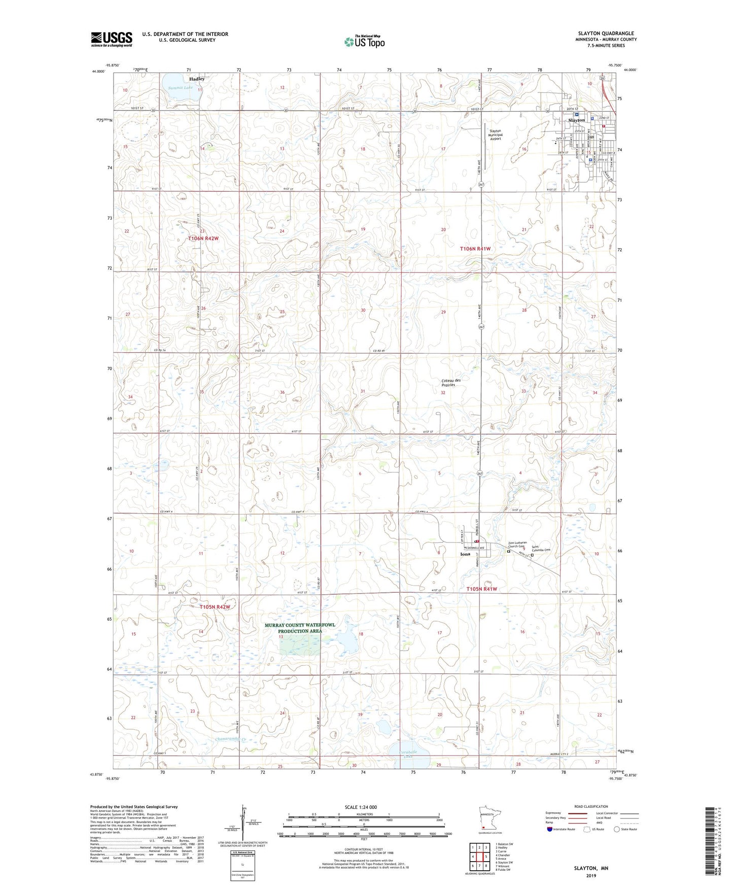
2022 topographic map quadrangle Slayton in the state of Minnesota. Scale: 1:24000. Based on the newly updated USGS 7.5' US Topo map series, this map is in the following counties: Murray. The map contains contour data, water features, and other items you are used to seeing on USGS maps, but also has updated roads and other features. This is the next generation of topographic maps. Printed on high-quality waterproof paper with UV fade-resistant inks.
Quads adjacent to this one:
West: Chandler
Northwest: Balaton SW
North: Hadley
Northeast: Currie
East: Avoca
Southeast: Fulda SW
South: Wilmont
Southwest: Slayton SW
This map covers the same area as the classic USGS quad with code o43095h7.
Contains the following named places: Assembly of God Church, City of Hadley, City of Iona, City of Slayton, Corabelle Lake, First Presbyterian Church, First Reformed Church, Iona, Iona Fire Department, Iona Lake, Iona Post Office, Murray County Central High School, Murray County Courthouse, Murray County Medical Center, Murray County Museum, Murray County Sheriff's Office, Ruthton Farms, Saint Ann's Catholic Church, Saint Columba Cemetery, Schoeberl State Wildlife Management Area, School Number 1261, Slayton, Slayton Baptist Church, Slayton Clinic, Slayton Fire Department, Slayton Municipal Airport, Slayton Police Department, Slayton Post Office, Slayton Public Library, Summit Lake, Township of Iona, Township of Slayton, Trinity Lutheran Church, United Methodist Church, West School, Zion Lutheran Church Cemetery, ZIP Code: 56141