MyTopo
Lime Creek Minnesota US Topo Map
Couldn't load pickup availability
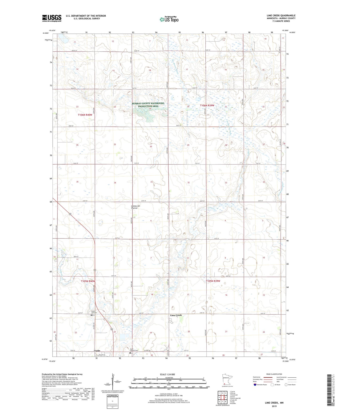
2022 topographic map quadrangle Lime Creek in the state of Minnesota. Scale: 1:24000. Based on the newly updated USGS 7.5' US Topo map series, this map is in the following counties: Murray. The map contains contour data, water features, and other items you are used to seeing on USGS maps, but also has updated roads and other features. This is the next generation of topographic maps. Printed on high-quality waterproof paper with UV fade-resistant inks.
Quads adjacent to this one:
West: Avoca
Northwest: Currie
North: Dovray
Northeast: Westbrook
East: Heron Lake NW
Southeast: Dundee
South: Fulda
Southwest: Fulda SW
This map covers the same area as the classic USGS quad with code o43095h5.
Contains the following named places: Devils Run, Haberman State Wildlife Management Area, Irrupption State Wildlife Management Area, Lime Creek, Lime Creek Post Office, Maple Lawn Nursing Home, Prairie Hill Cemetery, Saint Gabriel Cemetery, Township of Belfast, Township of Des Moines River, ZIP Code: 56114