MyTopo
Vineland Minnesota US Topo Map
Couldn't load pickup availability
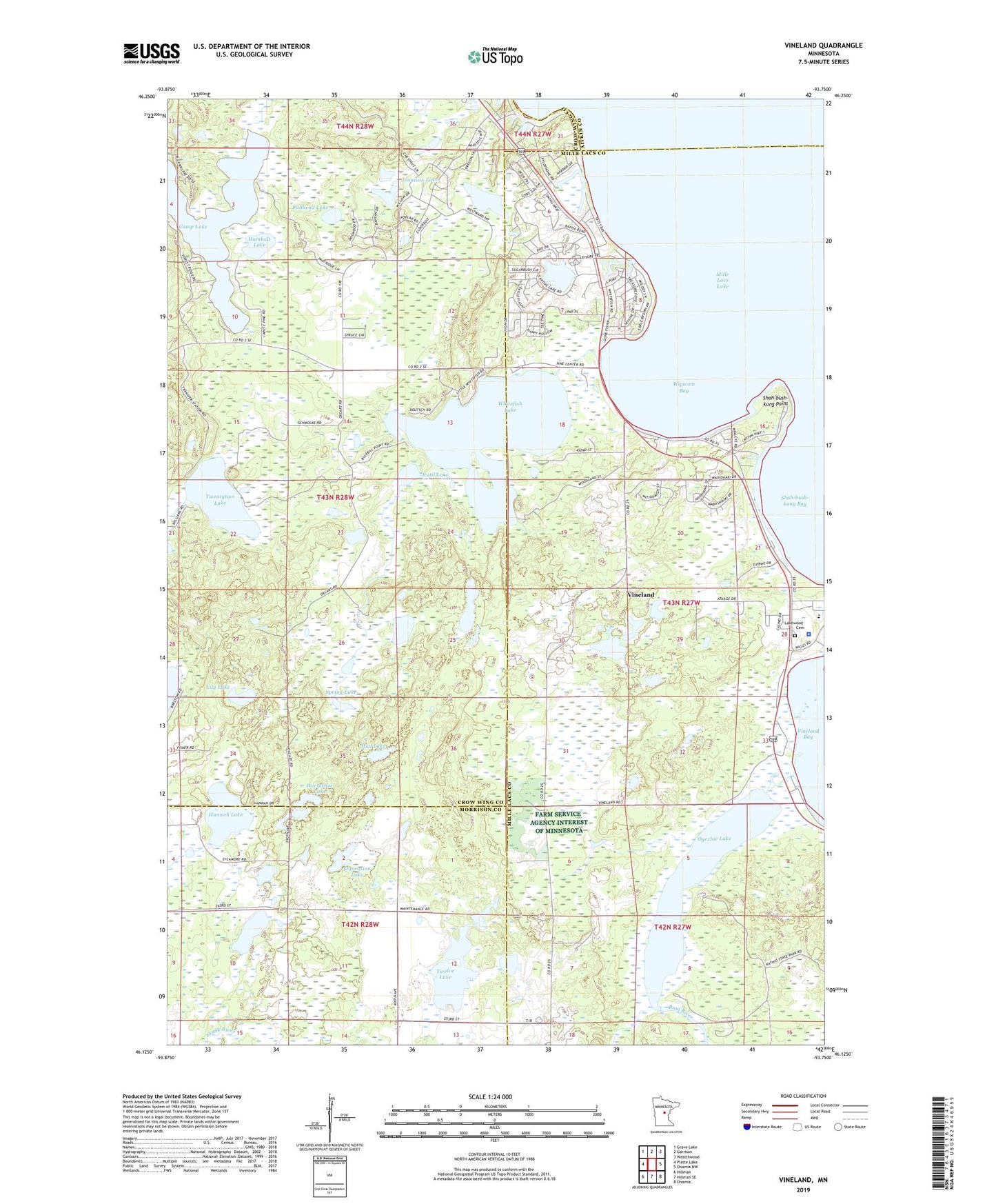
2022 topographic map quadrangle Vineland in the state of Minnesota. Scale: 1:24000. Based on the newly updated USGS 7.5' US Topo map series, this map is in the following counties: Crow Wing, Mille Lacs, Morrison, Aitkin. The map contains contour data, water features, and other items you are used to seeing on USGS maps, but also has updated roads and other features. This is the next generation of topographic maps. Printed on high-quality waterproof paper with UV fade-resistant inks.
Quads adjacent to this one:
West: Platte Lake
Northwest: Grave Lake
North: Garrison
Northeast: Wealthwood
East: Onamia NW
Southeast: Onamia
South: Hillman SE
Southwest: Hillman
This map covers the same area as the classic USGS quad with code o46093b7.
Contains the following named places: Alliance Mission, Bullhead Lake, Hannah Lake, Horseshoe Lake, Humbolt Lake, Jennison Lake, Kutil Lake, Lakewood Cemetery, Lily Lake, Little Flower Mission, Mille Lacs Tribal Police Department, Mud Lake, Ogechie Lake, Ogechie Lake Dam, Sewell Post Office, Shah-bush-kung Bay, Shah-bush-kung Point, Spring Lake, Starvation Lake, Township of Roosevelt, Twelve Lake, Twentytwo Lake, Vineland, Vineland Census Designated Place, Vineland School, White Bear Lake, Whitefish Lake, Whitefish Lake State Wildlife Management, Wigwam Bay, ZIP Code: 56450