MyTopo
Onamia NW Minnesota US Topo Map
Couldn't load pickup availability
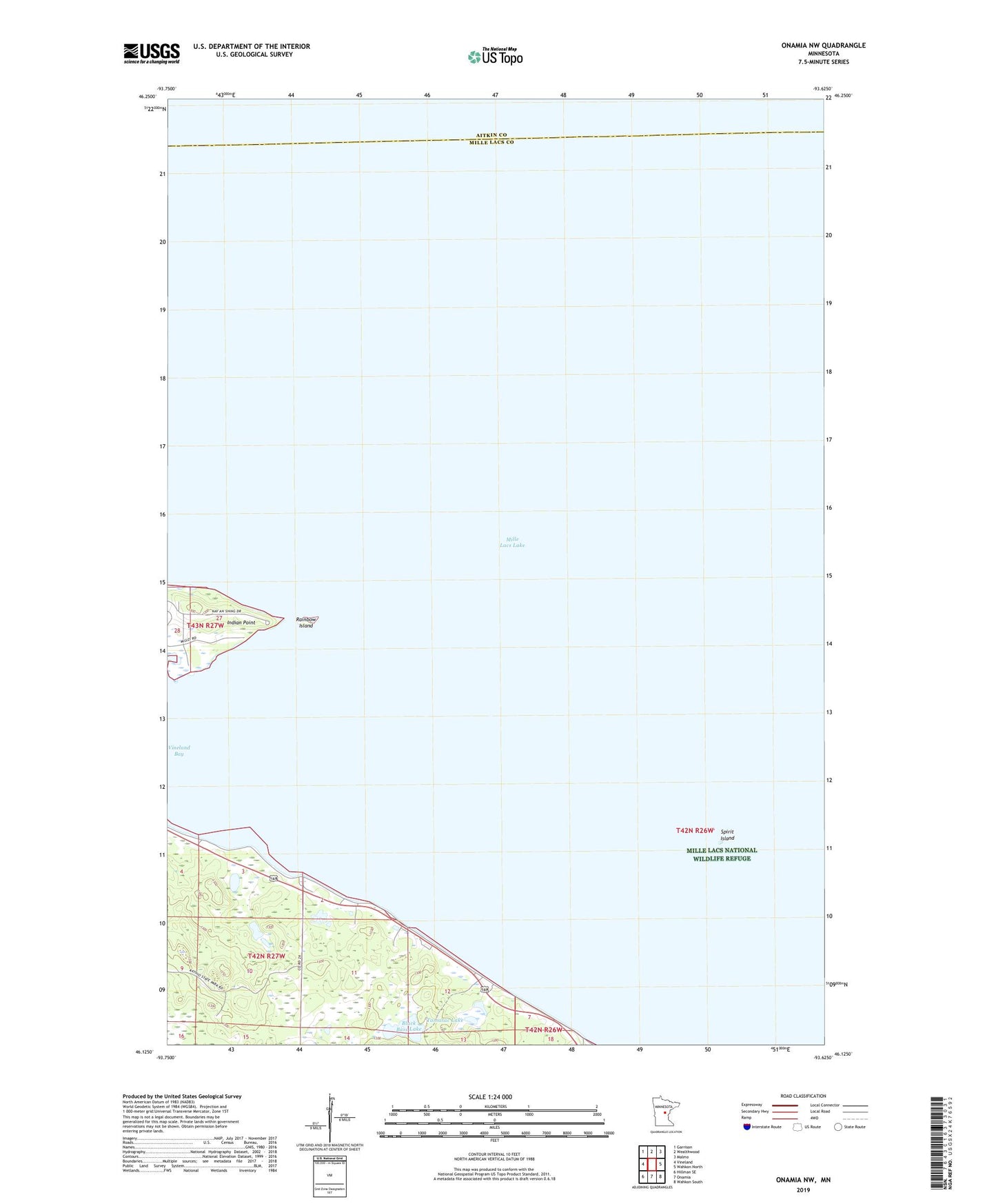
2022 topographic map quadrangle Onamia NW in the state of Minnesota. Scale: 1:24000. Based on the newly updated USGS 7.5' US Topo map series, this map is in the following counties: Mille Lacs, Aitkin. The map contains contour data, water features, and other items you are used to seeing on USGS maps, but also has updated roads and other features. This is the next generation of topographic maps. Printed on high-quality waterproof paper with UV fade-resistant inks.
Quads adjacent to this one:
West: Vineland
Northwest: Garrison
North: Wealthwood
Northeast: Malmo
East: Wahkon North
Southeast: Wahkon South
South: Onamia
Southwest: Hillman SE
This map covers the same area as the classic USGS quad with code o46093b6.
Contains the following named places: Black Bass Lake, Indian Point, Mille Lacs Kathio State Park, Mille Lacs Lake, Mille Lacs Reservation, Rainbow Island, Spirit Island, Tamarac Lake, Township of Kathio, Vineland Bay