MyTopo
Otisco Minnesota US Topo Map
Couldn't load pickup availability
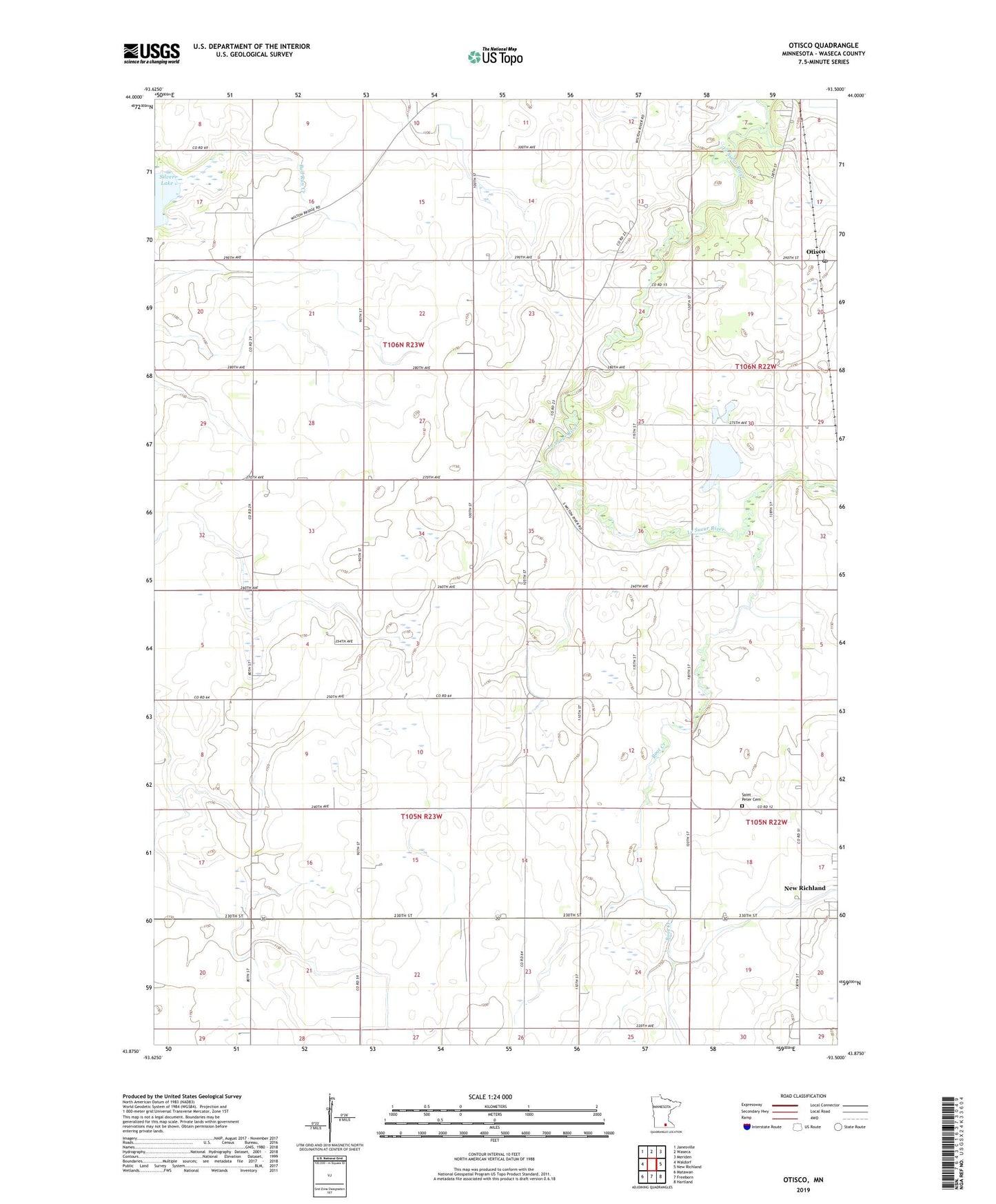
2022 topographic map quadrangle Otisco in the state of Minnesota. Scale: 1:24000. Based on the newly updated USGS 7.5' US Topo map series, this map is in the following counties: Waseca. The map contains contour data, water features, and other items you are used to seeing on USGS maps, but also has updated roads and other features. This is the next generation of topographic maps. Printed on high-quality waterproof paper with UV fade-resistant inks.
Quads adjacent to this one:
West: Waldorf
Northwest: Janesville
North: Waseca
Northeast: Meriden
East: New Richland
Southeast: Hartland
South: Freeborn
Southwest: Matawan
This map covers the same area as the classic USGS quad with code o43093h5.
Contains the following named places: Arneman Field, Boot Creek, County Ditch Number Fortythree, County Ditch Number Twenty, County Ditch Number Twentysix, Otisco, Otisco Post Office, Saint Peter Cemetery, Township of Byron, Township of Wilton, ZIP Code: 56072