MyTopo
Big Thunder Peak Minnesota US Topo Map
Couldn't load pickup availability
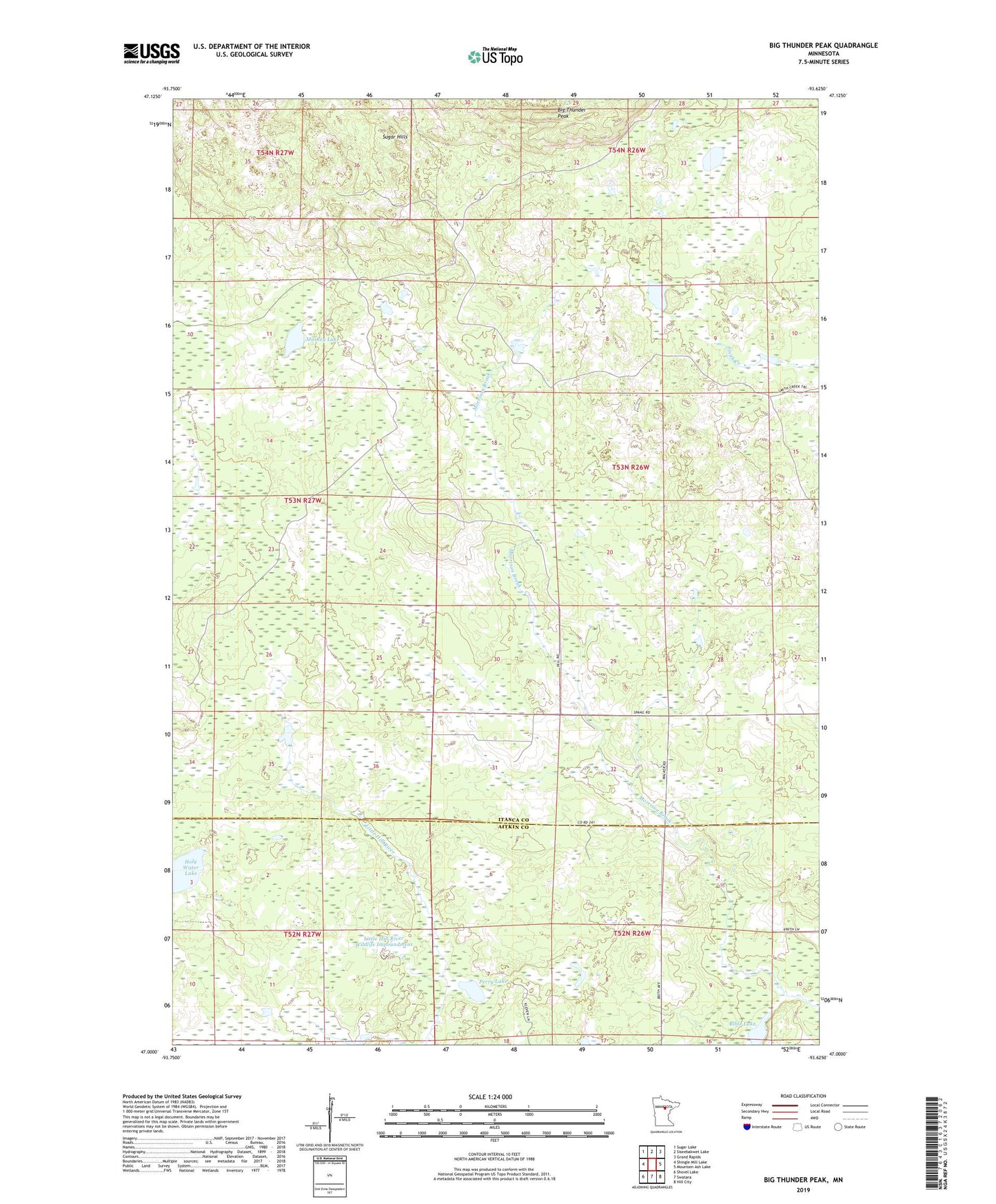
2022 topographic map quadrangle Big Thunder Peak in the state of Minnesota. Scale: 1:24000. Based on the newly updated USGS 7.5' US Topo map series, this map is in the following counties: Itasca, Aitkin. The map contains contour data, water features, and other items you are used to seeing on USGS maps, but also has updated roads and other features. This is the next generation of topographic maps. Printed on high-quality waterproof paper with UV fade-resistant inks.
Quads adjacent to this one:
West: Shingle Mill Lake
Northwest: Sugar Lake
North: Siseebakwet Lake
Northeast: Grand Rapids
East: Mountain Ash Lake
Southeast: Hill City
South: Swatara
Southwest: Shovel Lake
This map covers the same area as the classic USGS quad with code o47093a6.
Contains the following named places: Bible Lake, Big Thunder Peak, Hills Lake, Holy Water Lake, Little Hill River Wildlife Impoundment, Little Hill Wildlife Impoundment Dam, Muskeg Lake, Perry Lake, Sugar Hills, Township of Spang, William Lange Structure Dam