MyTopo
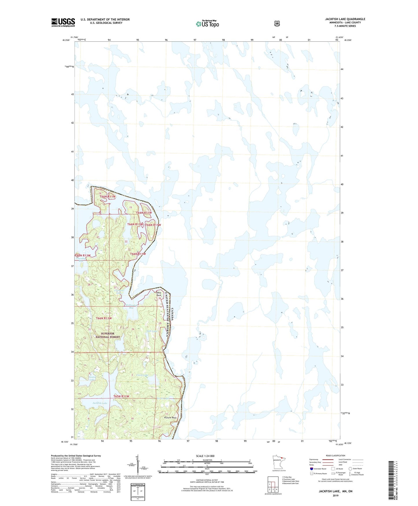
Jackfish Lake Minnesota US Topo Map
Couldn't load pickup availability
Also explore the Jackfish Lake Forest Service Topo of this same quad for updated USFS data
2022 topographic map quadrangle Jackfish Lake in the state of Minnesota. Scale: 1:24000. Based on the newly updated USGS 7.5' US Topo map series, this map is in the following counties: Lake. The map contains contour data, water features, and other items you are used to seeing on USGS maps, but also has updated roads and other features. This is the next generation of topographic maps. Printed on high-quality waterproof paper with UV fade-resistant inks.
Quads adjacent to this one:
West: Friday Bay
Southeast: Basswood Lake East
South: Basswood Lake West
Southwest: Fourtown Lake
This map covers the same area as the classic USGS quad with code o48091b6.
Contains the following named places: Circle Lake, Frolic Lake, Jackfish Lake, Picture Rock, Sash Lake, Sauna Lake, Table Rock, Wabosons Lake, Wednesday Bay