MyTopo
Jasper Minnesota US Topo Map
Couldn't load pickup availability
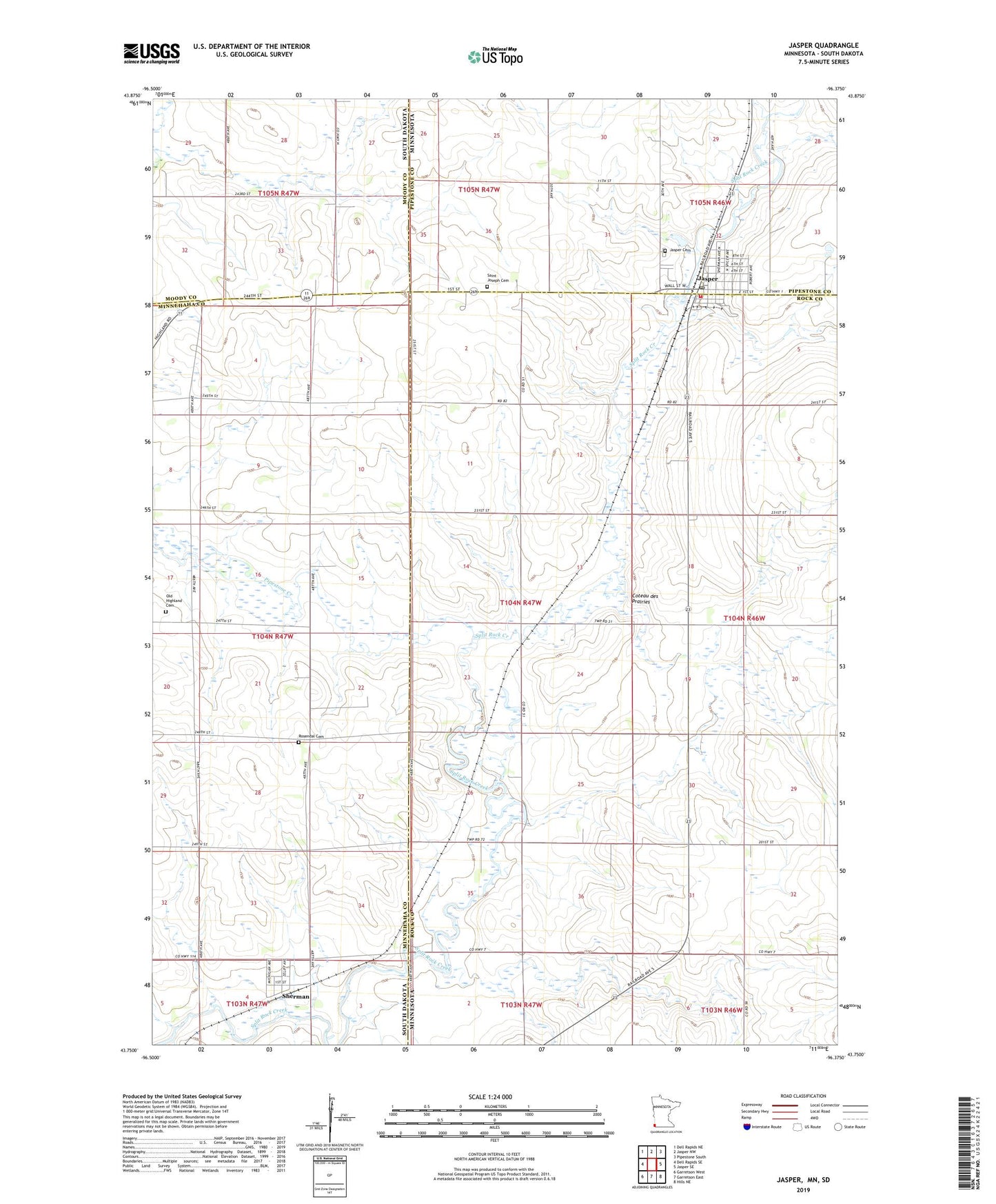
2022 topographic map quadrangle Jasper in the states of Minnesota, South Dakota. Scale: 1:24000. Based on the newly updated USGS 7.5' US Topo map series, this map is in the following counties: Rock, Minnehaha, Pipestone, Moody. The map contains contour data, water features, and other items you are used to seeing on USGS maps, but also has updated roads and other features. This is the next generation of topographic maps. Printed on high-quality waterproof paper with UV fade-resistant inks.
Quads adjacent to this one:
West: Dell Rapids SE
Northwest: Dell Rapids NE
North: Jasper NW
Northeast: Pipestone South
East: Jasper SE
Southeast: Hills NE
South: Garretson East
Southwest: Garretson West
Contains the following named places: City of Jasper, Jasper, Jasper Cemetery, Jasper Clinic, Jasper Community Ambulance Service, Jasper Evangelical Lutheran Church, Jasper Fire Department, Jasper Memorial Hall, Jasper Mini Mall, Jasper Post Office, Jasper Public School, Jasper Sunrise Village, Jasper Wastewater Treatment Plant, Minnesota Noname Number 1 Dam, Old Highland Cemetery, Pipestone Creek, Rosendal Cemetery, Saint Joseph Cemetery, Saint Joseph's Catholic Church, Sherman, Sherman Fire Department, Sherman Town Hall, Town of Sherman, Township of Highland, Trinity Lutheran Church, ZIP Code: 56144