MyTopo
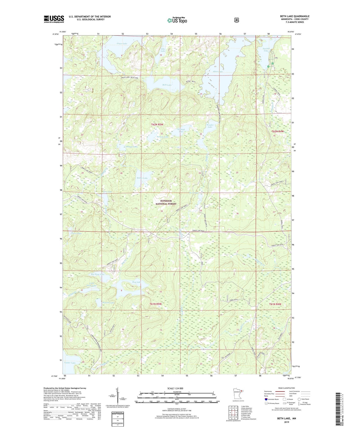
Beth Lake Minnesota US Topo Map
Couldn't load pickup availability
Also explore the Beth Lake Forest Service Topo of this same quad for updated USFS data
2022 topographic map quadrangle Beth Lake in the state of Minnesota. Scale: 1:24000. Based on the newly updated USGS 7.5' US Topo map series, this map is in the following counties: Cook. The map contains contour data, water features, and other items you are used to seeing on USGS maps, but also has updated roads and other features. This is the next generation of topographic maps. Printed on high-quality waterproof paper with UV fade-resistant inks.
Quads adjacent to this one:
West: Kawishiwi Lake
Northwest: Lake Polly
North: Kelso Mountain
Northeast: Cherokee Lake
East: Sawbill Camp
Southeast: Honeymoon Mountain
South: Toohey Lake
Southwest: Wilson Lake
This map covers the same area as the classic USGS quad with code o47090g8.
Contains the following named places: Alton Lake, Beth Lake, Big Snow Lake, Bollar Lake, Clover Lake, Ella Lake, Grace Lake, Hog Lake, Little Snow Lake, Maggie Creek, Maggie Lake, Paoli Lake, Pecore Creek, Retreat Lake, Sawbill Campground, Sawbill Guard Station, Sunhigh Lake, Sunlow Lake, Timber Creek, Timber Lake, Vyre Lake, Wonder Lake