MyTopo
Pomme De Terre Lakes Minnesota US Topo Map
Couldn't load pickup availability
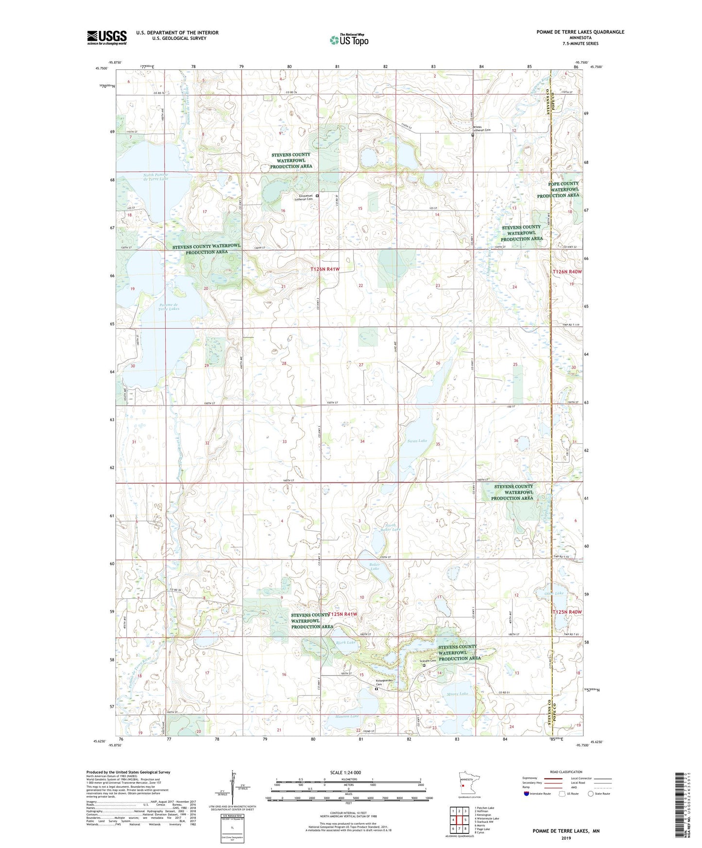
2022 topographic map quadrangle Pomme De Terre Lakes in the state of Minnesota. Scale: 1:24000. Based on the newly updated USGS 7.5' US Topo map series, this map is in the following counties: Stevens, Pope. The map contains contour data, water features, and other items you are used to seeing on USGS maps, but also has updated roads and other features. This is the next generation of topographic maps. Printed on high-quality waterproof paper with UV fade-resistant inks.
Quads adjacent to this one:
West: Wintermute Lake
Northwest: Patchen Lake
North: Hoffman
Northeast: Kensington
East: Starbuck NW
Southeast: Cyrus
South: Page Lake
Southwest: Morris
This map covers the same area as the classic USGS quad with code o45095f7.
Contains the following named places: Aeneas Church, Aeneas Lutheran Cemetery, Baker Lake, Bjork Lake, Emmanuel Church, Emmanuel Lutheran Cemetery, Erickson Lake, Hanson Lake, Kirkegaarden Cemetery, Klason State Wildlife Management Area, Middle Pomme de Terre Lake, Moore Lake, North Baker Lake, North Pomme de Terre Lake, North Star Mill, Otter Lake, Perkins Lake, Perkins Lake Dam, Pomme de Terre Lakes, Scandia Cemetery, Scandia Church, Scandia Lake, School Number 10, School Number 34, School Number 38, School Number 41, School Number 5, School Number 66, Swan Lake, Township of Framnas, Township of Swan Lake