MyTopo
Paynesville Minnesota US Topo Map
Couldn't load pickup availability
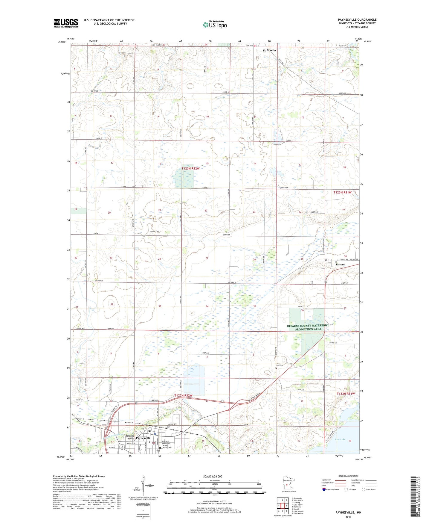
2022 topographic map quadrangle Paynesville in the state of Minnesota. Scale: 1:24000. Based on the newly updated USGS 7.5' US Topo map series, this map is in the following counties: Stearns. The map contains contour data, water features, and other items you are used to seeing on USGS maps, but also has updated roads and other features. This is the next generation of topographic maps. Printed on high-quality waterproof paper with UV fade-resistant inks.
Quads adjacent to this one:
West: Lake Henry
Northwest: Greenwald
North: Saint Martin
Northeast: Farming
East: Richmond
Southeast: Eden Valley
South: Lake Koronis
Southwest: Hawick
This map covers the same area as the classic USGS quad with code o45094d6.
Contains the following named places: Bonanza Valley, Calvary Baptist Church, City of Paynesville, City of Roscoe, Good Samaritan Care Center, Grace United Methodist Church, Nordland Lutheran Church, Paynesville, Paynesville Elementary School, Paynesville Fire Department, Paynesville Lutheran Church, Paynesville Police Department, Paynesville Post Office, Paynesville Public Library, Roscoe, Roscoe Post Office, Saint Agnes Catholic Church, Saint Louis Catholic Church, Saint Louis Catholic Church Cemetery, Saint Martin Volunteer Fire and Rescue Department, Saint Stephens Episcopal Church, Salem Cemetery, Salem Church, School Number 1948, School Number 1966, School Number 2028, Township of Zion, Zion Cemetery, ZIP Codes: 56362, 56371