MyTopo
Lamberton Minnesota US Topo Map
Couldn't load pickup availability
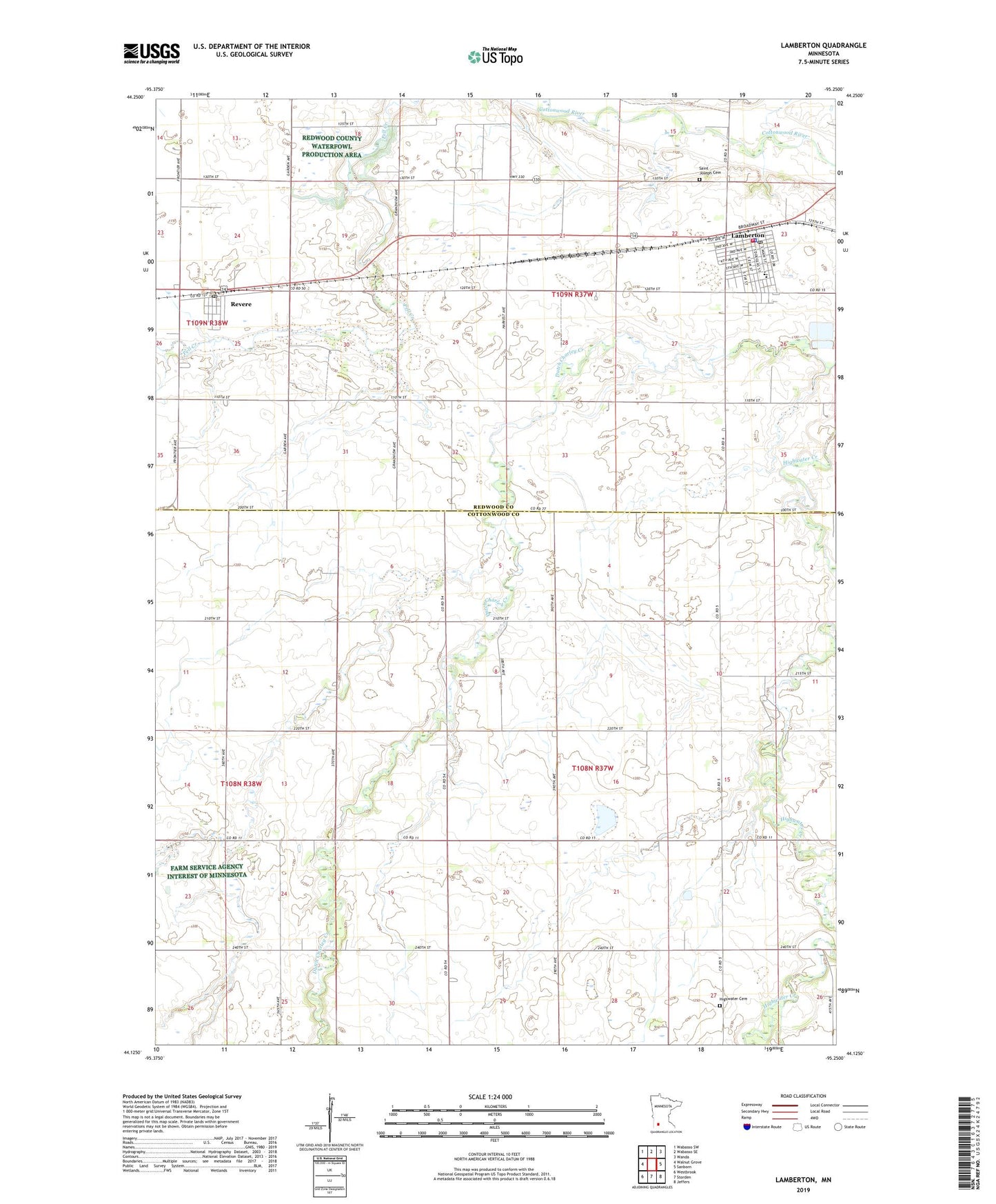
2019 topographic map quadrangle Lamberton in the state of Minnesota. Scale: 1:24000. Based on the newly updated USGS 7.5' US Topo map series, this map is in the following counties: Cottonwood, Redwood. The map contains contour data, water features, and other items you are used to seeing on USGS maps, but also has updated roads and other features. This is the next generation of topographic maps. Printed on high-quality waterproof paper with UV fade-resistant inks.
Quads adjacent to this one:
West: Walnut Grove
Northwest: Wabasso SW
North: Wabasso SE
Northeast: Wanda
East: Sanborn
Southeast: Jeffers
South: Storden
Southwest: Westbrook
Contains the following named places: City of Lamberton, City of Revere, Highwater Cemetery, Highwater Church, Kuhar Park, Lamberton, Lamberton Clinic, Lamberton Fire Department and Ambulance Service, Lamberton Police Department, Lamberton Post Office, Lamberton Public Library, Our Saviour's Lutheran Church, Red Rock Central High School, Redwood County Waterfowl Production Area, Revere, Revere Fire Station, Revere Post Office, Revere Town Hall, Saint Joseph Cemetery, Saint Joseph's Church, Township of Highwater, Township of Lamberton, United Methodist Church, University of Minnesota Experimental Station, Valley View Manor, ZIP Code: 56152