MyTopo
Westbrook Minnesota US Topo Map
Couldn't load pickup availability
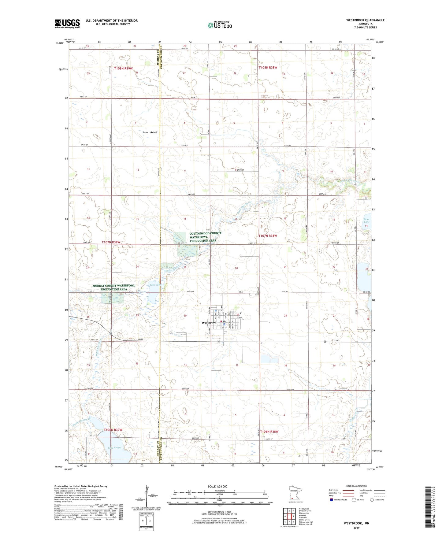
2022 topographic map quadrangle Westbrook in the state of Minnesota. Scale: 1:24000. Based on the newly updated USGS 7.5' US Topo map series, this map is in the following counties: Cottonwood, Murray. The map contains contour data, water features, and other items you are used to seeing on USGS maps, but also has updated roads and other features. This is the next generation of topographic maps. Printed on high-quality waterproof paper with UV fade-resistant inks.
Quads adjacent to this one:
West: Dovray
Northwest: Tracy East
North: Walnut Grove
Northeast: Lamberton
East: Storden
Southeast: Heron Lake NE
South: Heron Lake NW
Southwest: Lime Creek
This map covers the same area as the classic USGS quad with code o44095a4.
Contains the following named places: City of Westbrook, Grace Lutheran Church, Immanuel Baptist Church, Judicial Ditch Number Three, Lake Julia, Lake Louisa, Rolling Hills Golf Club, Saint Anthony's Church, Snow Lakebed, South Dutch Charlie County Park, Township of Westbrook, Trinity Lutheran Church, United Presbyterian Church, Westbrook, Westbrook Christian School, Westbrook City Hall, Westbrook Health Medical Center, Westbrook Heritage House Museum, Westbrook High School, Westbrook Library, Westbrook Police Department, Westbrook Post Office, Westbrook Volunteer Fire Department, ZIP Code: 56183