MyTopo
Lawler Minnesota US Topo Map
Couldn't load pickup availability
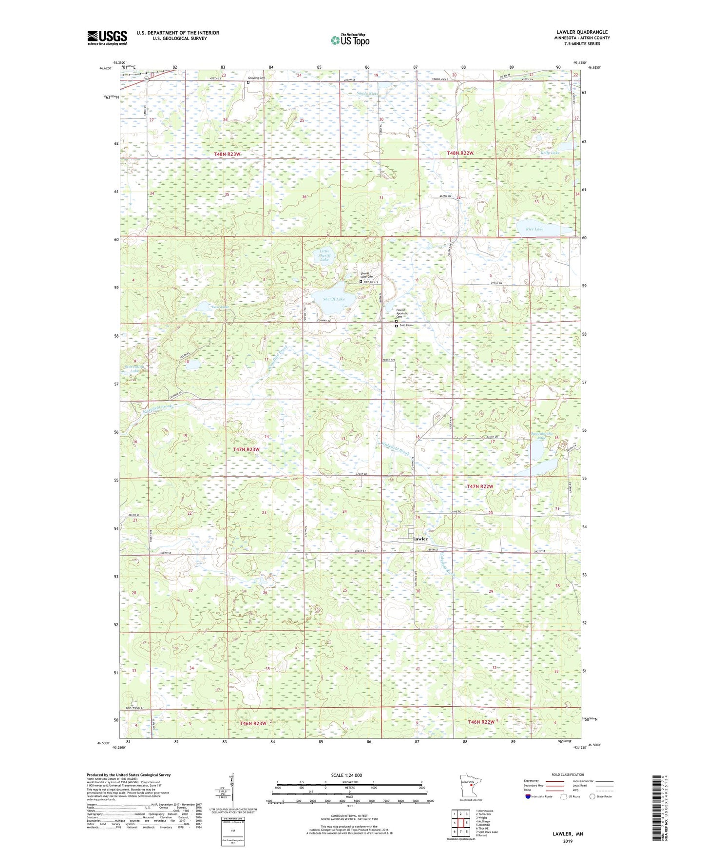
2022 topographic map quadrangle Lawler in the state of Minnesota. Scale: 1:24000. Based on the newly updated USGS 7.5' US Topo map series, this map is in the following counties: Aitkin. The map contains contour data, water features, and other items you are used to seeing on USGS maps, but also has updated roads and other features. This is the next generation of topographic maps. Printed on high-quality waterproof paper with UV fade-resistant inks.
Quads adjacent to this one:
West: McGregor
Northwest: Minnewawa
North: Tamarack
Northeast: Wright
East: Automba
Southeast: Ronald
South: Split Rock Lake
Southwest: Thor NE
This map covers the same area as the classic USGS quad with code o46093e2.
Contains the following named places: Dutch Lake, Finnish Apostolic Cemetery, Grayling Cemetery, Kelly Lake, Lawler, Lawler Lookout Tower, Lawler Post Office, Lawler Wildlife Management Area, Little Sheriff Lake, Lost Lake, Rice Lake, Salo Cemetery, Sandabacka Lake, Sheriff Lake, Sheriff Lake Cemetery, Sheriff Lake Tabernacle, Tamarack Church, Township of Spalding