MyTopo
Longville Minnesota US Topo Map
Couldn't load pickup availability
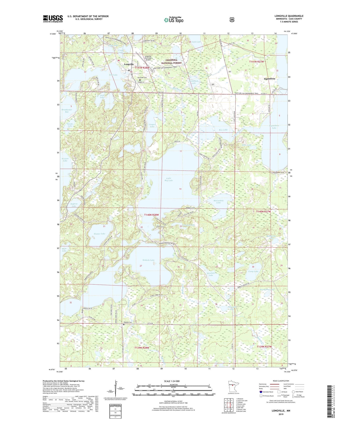
2019 topographic map quadrangle Longville in the state of Minnesota. Scale: 1:24000. Based on the newly updated USGS 7.5' US Topo map series, this map is in the following counties: Cass. The map contains contour data, water features, and other items you are used to seeing on USGS maps, but also has updated roads and other features. This is the next generation of topographic maps. Printed on high-quality waterproof paper with UV fade-resistant inks.
Quads adjacent to this one:
West: Woman Lake
Northwest: Whipholt
North: Town Line Lake
Northeast: Tobique
East: Laura Lake
Southeast: Mitchell Lake
South: Stewart Lake
Southwest: Lake Ada
Contains the following named places: Blueberry Lake, Brackett Lake, Bullhead Lake, Camp Lake, Camp Olson, Charles Lake, City of Longville, Cooper Lake, Craig Lake, Crooked Lake, Deer Trail Resort and Campground, Echo Lake, Gijik Lake, Girl Lake, Girl Lake Seaplane Base, Heffron Lake, Hunter Lake, Inguadona, Inguadona Lake, Inguadona Post Office, Jack Lake, Little Boy Lake, Little Boy Resort and Campground, Longville, Longville Bible Church, Longville Campground, Longville City Hall, Longville Community Church, Longville Elementary School, Longville Lakes Clinic, Longville Lookout Tower, Longville Municipal Airport, Longville Police Department, Longville Post Office, Longville Volunteer Fire Department, Margaret Welch Memorial Library, McCarthey Lake, Nellie Lake, North Memorial Ambulance Service Longville, Rice Lake, Ridgewood Golf Course, Riverside Cemetery, Saint Edwards Catholic Church, Salem Lutheran Church, Shurd Lakes, Spring Creek, Swede Lake, Tamarack Lake, Thirtysix Lake, Township of Wabedo, Wabedo, Wabedo Cemetery, Wabedo Creek, Wabedo Lake, Wabedo Post Office, Woodcamp Lake