MyTopo
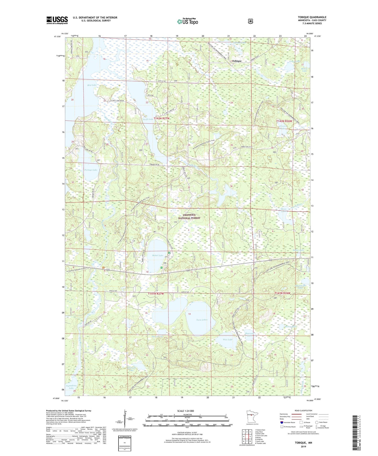
Tobique Minnesota US Topo Map
Couldn't load pickup availability
Also explore the Tobique Forest Service Topo of this same quad for updated USFS data
2022 topographic map quadrangle Tobique in the state of Minnesota. Scale: 1:24000. Based on the newly updated USGS 7.5' US Topo map series, this map is in the following counties: Cass. The map contains contour data, water features, and other items you are used to seeing on USGS maps, but also has updated roads and other features. This is the next generation of topographic maps. Printed on high-quality waterproof paper with UV fade-resistant inks.
Quads adjacent to this one:
West: Town Line Lake
Northwest: Federal Dam
North: Boy River
Northeast: Goose Lake
East: Remer
Southeast: Thunder Lake
South: Laura Lake
Southwest: Longville
This map covers the same area as the classic USGS quad with code o47094a1.
Contains the following named places: Bailey Lake, Bebow Lake, Dollar Lake, Grass Lake, Green Lake, Little Swift Lake, Lost Girl Lake, Mabel Lake, Mabel Lake Campground, Moon Lake, Ododikossi Lake, Peterson Lake, Phelon Lake, Portage Lake, Remer Lookout Tower, Swift Lake, Swift River, Tobique, Tobique Lake, Tobique Post Office, Township of Inguadona, Township of Rogers, Twin Lakes, Wax Lake, ZIP Code: 56672