MyTopo
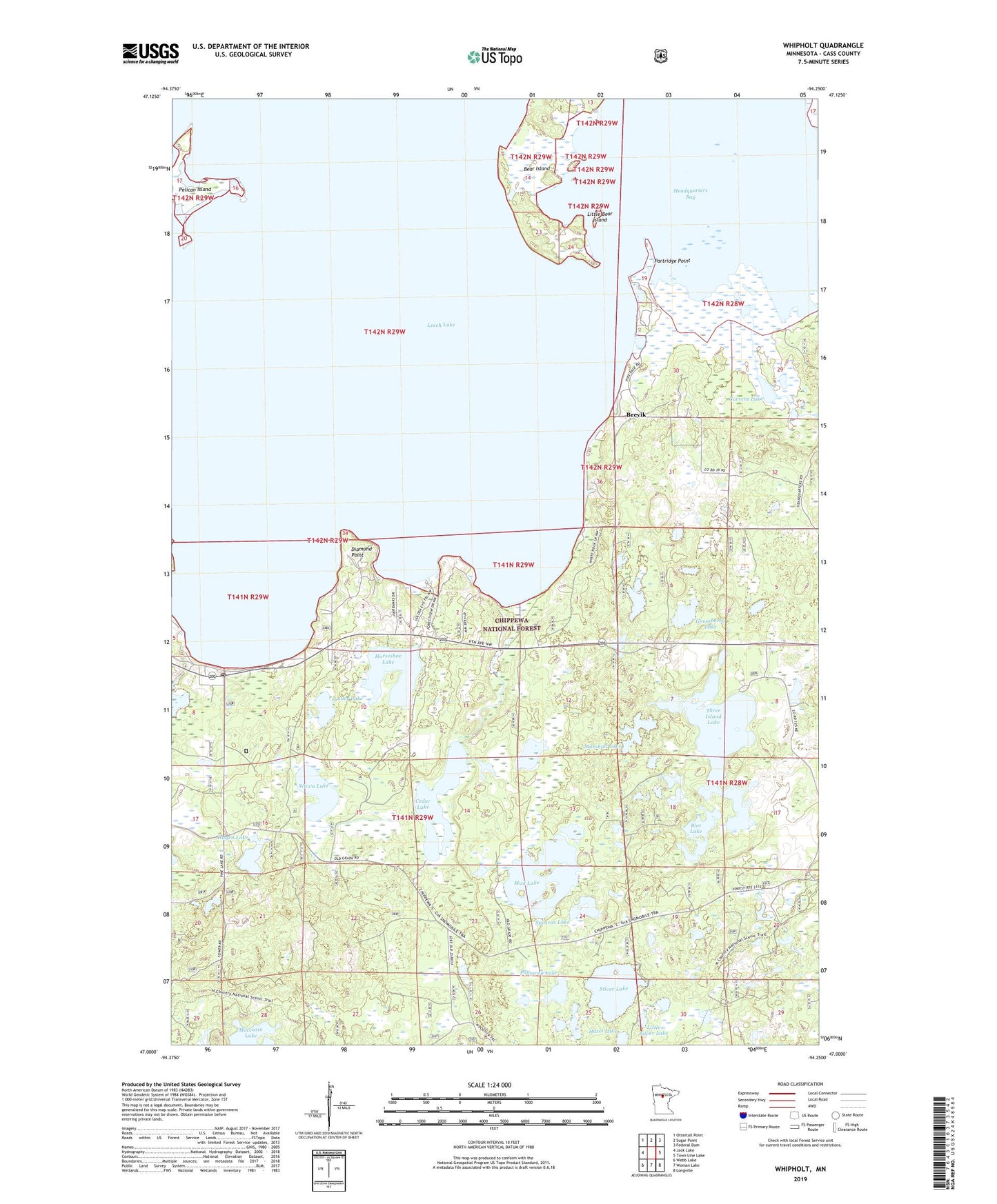
Whipholt Minnesota US Topo Map
Couldn't load pickup availability
Also explore the Whipholt Forest Service Topo of this same quad for updated USFS data
2022 topographic map quadrangle Whipholt in the state of Minnesota. Scale: 1:24000. Based on the newly updated USGS 7.5' US Topo map series, this map is in the following counties: Cass. The map contains contour data, water features, and other items you are used to seeing on USGS maps, but also has updated roads and other features. This is the next generation of topographic maps. Printed on high-quality waterproof paper with UV fade-resistant inks.
Quads adjacent to this one:
West: Jack Lake
Northwest: Ottertail Point
North: Sugar Point
Northeast: Federal Dam
East: Town Line Lake
Southeast: Longville
South: Woman Lake
Southwest: Webb Lake
This map covers the same area as the classic USGS quad with code o47094a3.
Contains the following named places: Blot Lake, Brevik, Brevik Post Office, Cedar Lake, Current Lake, Diamond Point, Gooseberry Lake, Hagen Lake, Hazel Lake, Headquarters Bay, Horseshoe Lake, Lauer Lake, Little Bear Island, Little Silver Lake, Marshall Lake, Mud Lake, Partridge Point, Pelican Island, Pipe Island, Pollywog Lake, Silver Lake, Spearns Lake, Sugar Point Battle Historical Marker, Three Island Lake, Township of Pine Lake, Wawa Lake, Whipholt, Whipholt Creek, Whipholt Lookout Tower, Whipholt Post Office, Whipholt Roadside Park