MyTopo
Onamia Minnesota US Topo Map
Couldn't load pickup availability
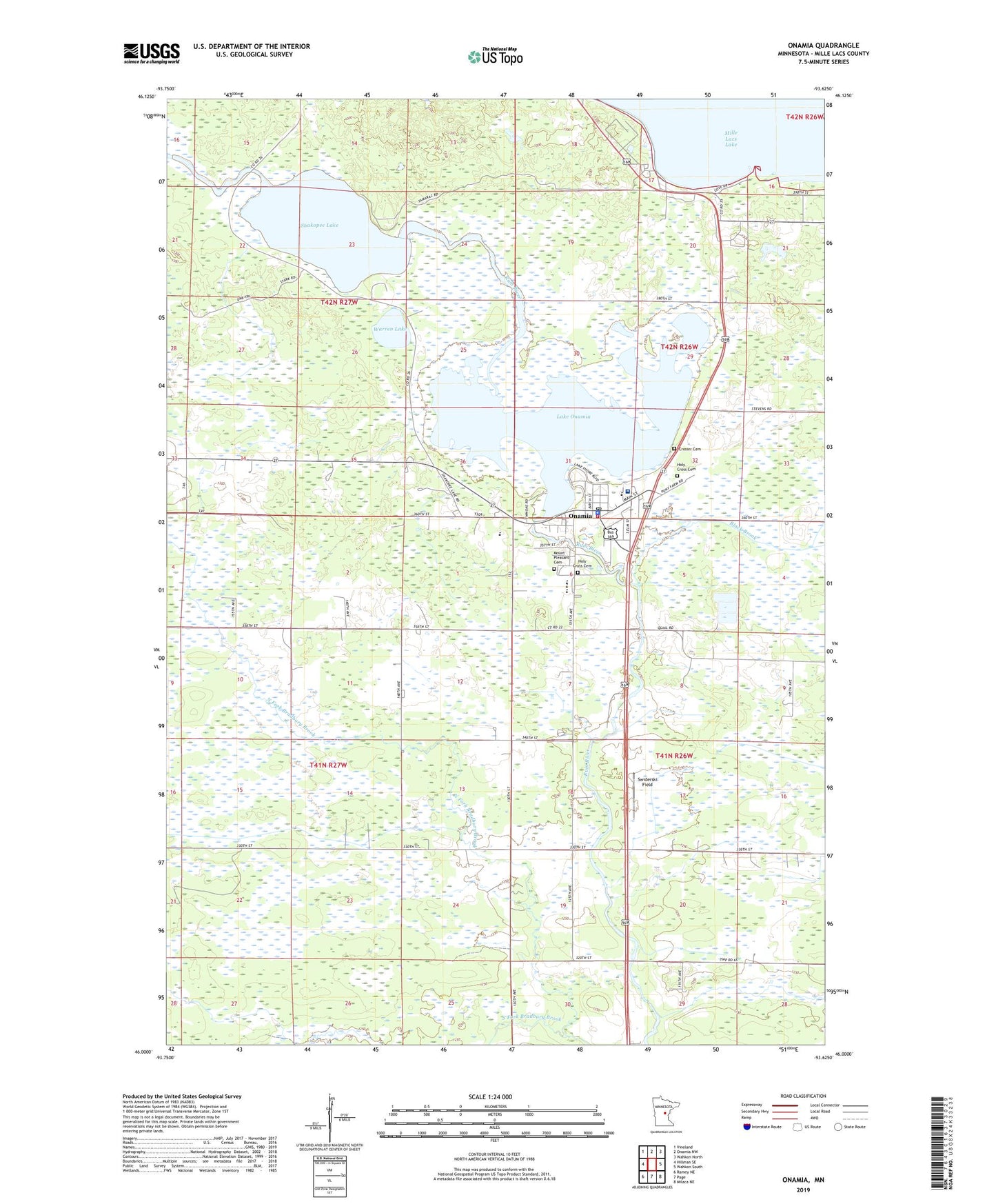
2022 topographic map quadrangle Onamia in the state of Minnesota. Scale: 1:24000. Based on the newly updated USGS 7.5' US Topo map series, this map is in the following counties: Mille Lacs. The map contains contour data, water features, and other items you are used to seeing on USGS maps, but also has updated roads and other features. This is the next generation of topographic maps. Printed on high-quality waterproof paper with UV fade-resistant inks.
Quads adjacent to this one:
West: Hillman SE
Northwest: Vineland
North: Onamia NW
Northeast: Wahkon North
East: Wahkon South
Southeast: Milaca NE
South: Page
Southwest: Ramey NE
This map covers the same area as the classic USGS quad with code o46093a6.
Contains the following named places: Black Brook, City of Onamia, Crosier Cemetery, Crosier Seminary, Holy Cross Cemetery, Lake Onamia, Mille Lacs Health System Hospital, Mille Lacs Heliport, Mille Lacs Nursing Home, Mount Pleasant Cemetery, North Fork Bradbury Brook, Onamia, Onamia Lake Dam, Onamia Police Department, Onamia Post Office, Onamia Volunteer Fire Department, Shakopee Lake, South Fork Bradbury Brook, Swiderski Field, Township of Bradbury, Warren Lake, ZIP Code: 56359