MyTopo
Mildred Minnesota US Topo Map
Couldn't load pickup availability
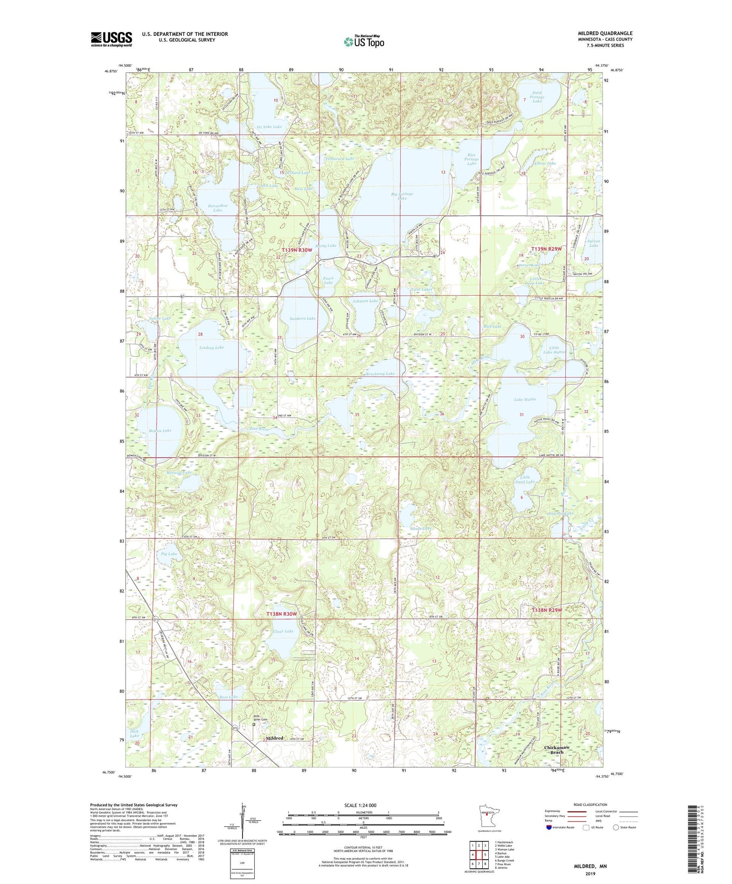
2019 topographic map quadrangle Mildred in the state of Minnesota. Scale: 1:24000. Based on the newly updated USGS 7.5' US Topo map series, this map is in the following counties: Cass. The map contains contour data, water features, and other items you are used to seeing on USGS maps, but also has updated roads and other features. This is the next generation of topographic maps. Printed on high-quality waterproof paper with UV fade-resistant inks.
Quads adjacent to this one:
West: Backus
Northwest: Hackensack
North: Webb Lake
Northeast: Woman Lake
East: Lake Ada
Southeast: Jenkins
South: Pine River
Southwest: Bungo Creek
Contains the following named places: Bass Lake, Big Portage Lake, Boot Lake, Bowen Lake, Bowen Lake Dam, Brockway Lake, Clear Lake, Corset Lake, Crooked Lake, Deep Portage Lake, Dick Lake, Ding Pot Lake, Elbow Lake, Fawn Lake, Hattie Lake Dam, Horse Lake, Horseshoe Lake, Johnson Lake, Lake Hattie, Lindsey Lake, Lindsey Lake Campgrounds, Little Deep Lake, Little Lake Hattie, Little Sand Lake, Lizzie Creek, Loon Lake, Mildred, Mildred Bible Chapel, Mildred Post Office, Minnow Lake, Mud Lake, Ox Yoke Lake, Pig Lake, Pine River Cemetery, Portage Lake, Portage Lake Dam, Rainy Lake, Rice Portage Lake, Sanborn Lake, Swede Lake, Sylvan Lake, Tamarack Lake, Township of Pine River, Township of Powers, Tuck-A-Way Resort and Campground, Twin Lakes, Willard Lake