MyTopo
Minnesota Falls Minnesota US Topo Map
Couldn't load pickup availability
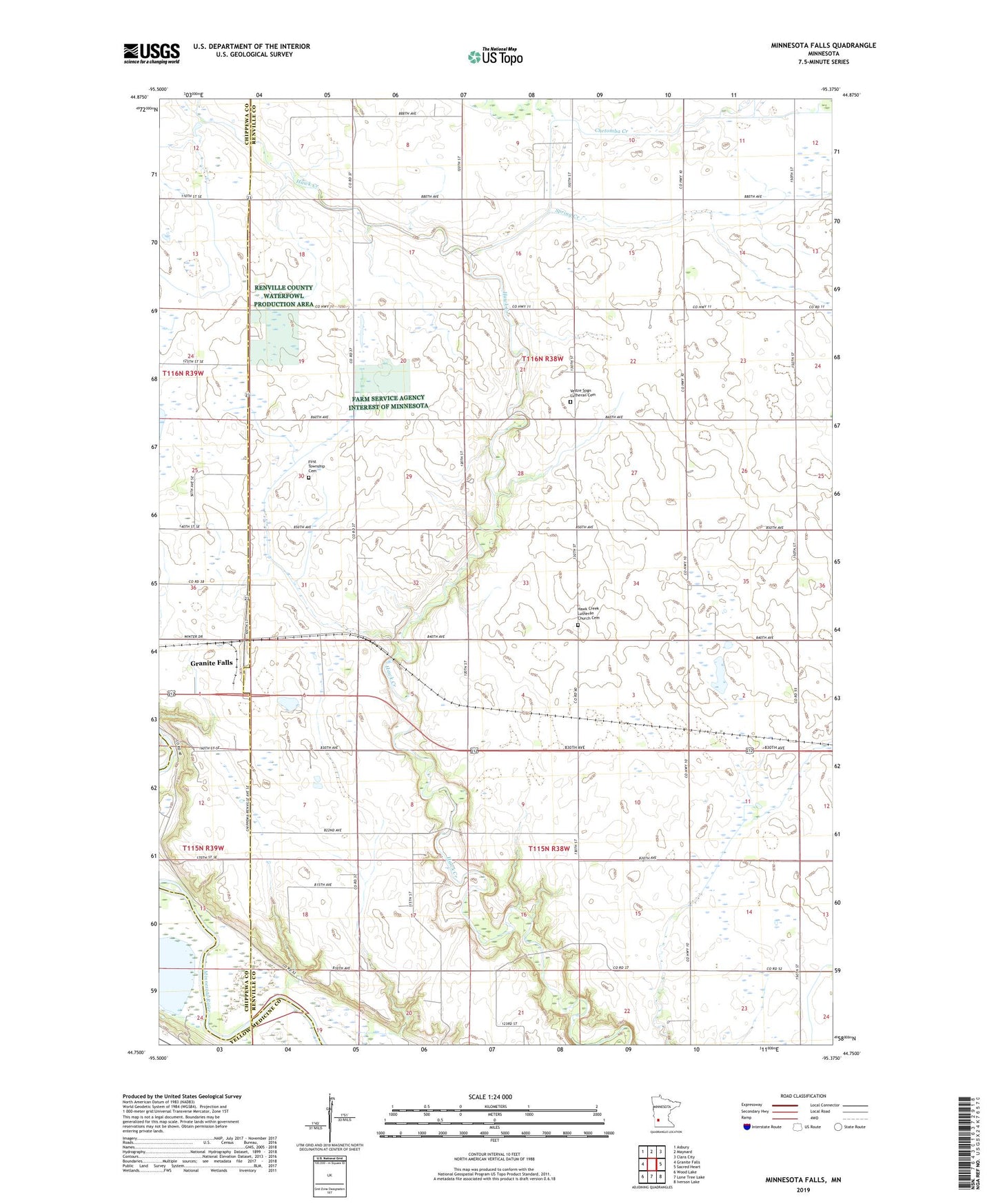
2019 topographic map quadrangle Minnesota Falls in the state of Minnesota. Scale: 1:24000. Based on the newly updated USGS 7.5' US Topo map series, this map is in the following counties: Renville, Chippewa, Yellow Medicine. The map contains contour data, water features, and other items you are used to seeing on USGS maps, but also has updated roads and other features. This is the next generation of topographic maps. Printed on high-quality waterproof paper with UV fade-resistant inks.
Quads adjacent to this one:
West: Granite Falls
Northwest: Asbury
North: Maynard
Northeast: Clara City
East: Sacred Heart
Southeast: Iverson Lake
South: Lone Tree Lake
Southwest: Wood Lake
Contains the following named places: County Ditch Number One Hundred Four, County Ditch Number Seventyfive, County Ditch Number Thirtysix, First Township Cemetery, Hawk Creek Church, Hawk Creek Lutheran Church Cemetery, Johnson Airport, Spring Creek, Township of Hawk Creek, Township of Wang, Vesper Song Chapel, Vestre Sogn Lutheran Cemetery