MyTopo
Waldorf Minnesota US Topo Map
Couldn't load pickup availability
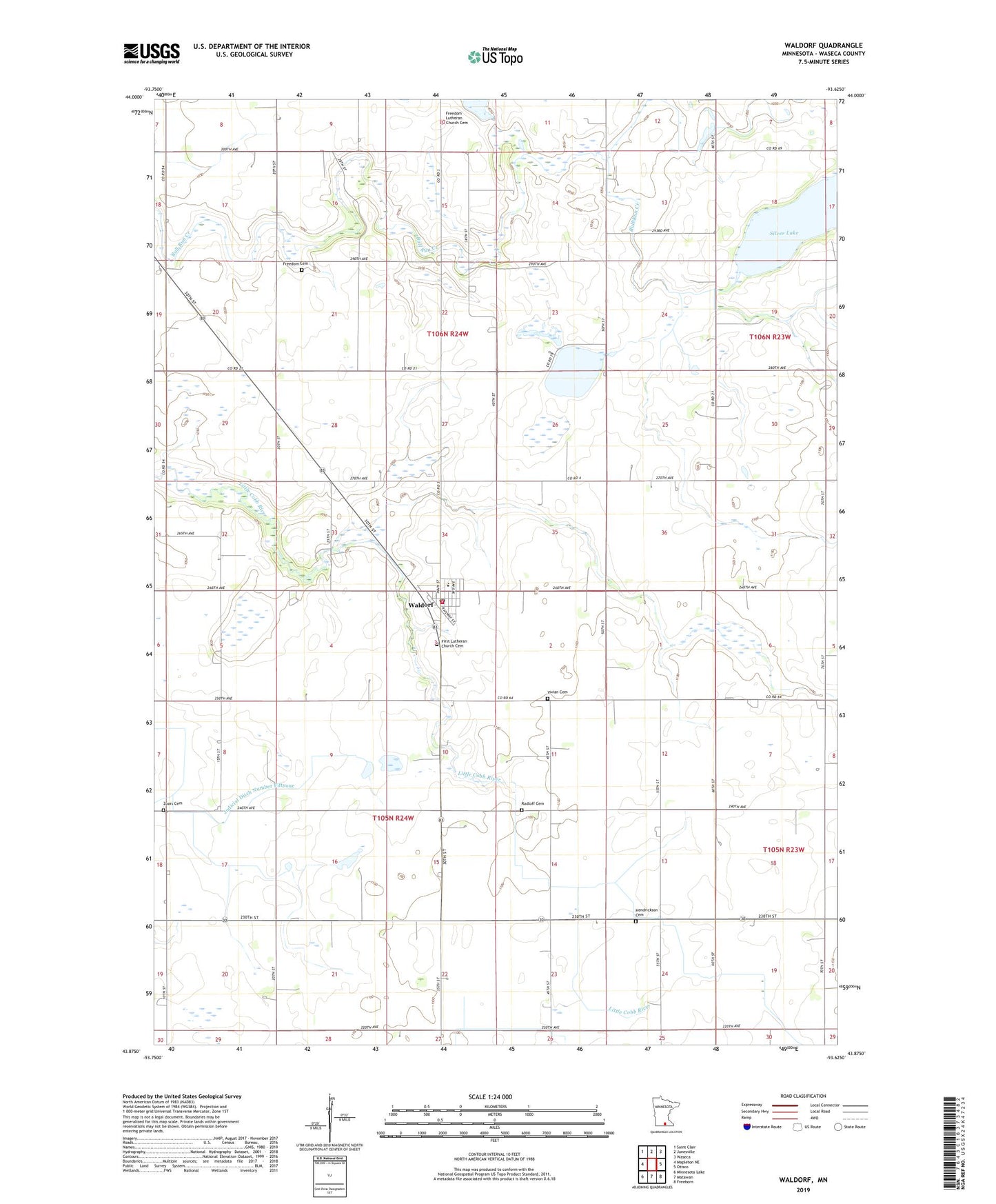
2022 topographic map quadrangle Waldorf in the state of Minnesota. Scale: 1:24000. Based on the newly updated USGS 7.5' US Topo map series, this map is in the following counties: Waseca. The map contains contour data, water features, and other items you are used to seeing on USGS maps, but also has updated roads and other features. This is the next generation of topographic maps. Printed on high-quality waterproof paper with UV fade-resistant inks.
Quads adjacent to this one:
West: Mapleton NE
Northwest: Saint Clair
North: Janesville
Northeast: Waseca
East: Otisco
Southeast: Freeborn
South: Matawan
Southwest: Minnesota Lake
This map covers the same area as the classic USGS quad with code o43093h6.
Contains the following named places: City of Waldorf, County Ditch Number Forty, First Lutheran Church, First Lutheran Church Cemetery, Freedom Cemetery, Freedom Lutheran Church Cemetery, Hendrickson Cemetery, Immanuel Church, Mueller State Wildlife Management Area, Radloff Cemetery, Saint Joseph's Church, Silver Lake, Silver Lake Dam, Township of Freedom, Township of Vivian, Vivian Cemetery, Waldorf, Waldorf City Hall, Waldorf Fire Department, Waldorf High School, Waldorf Post Office, Waldorf Public Library, Zoars Cemetery, ZIP Code: 56091