MyTopo
Grasston Minnesota US Topo Map
Couldn't load pickup availability
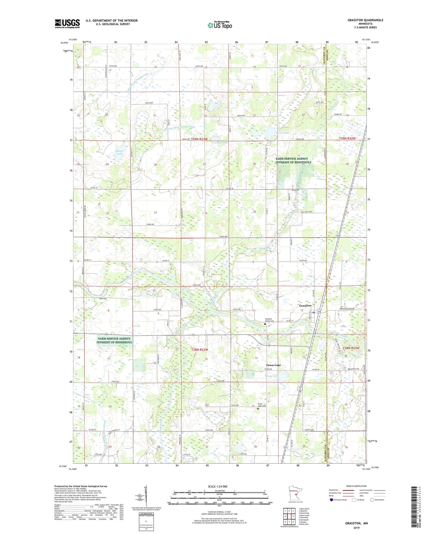
2022 topographic map quadrangle Grasston in the state of Minnesota. Scale: 1:24000. Based on the newly updated USGS 7.5' US Topo map series, this map is in the following counties: Kanabec, Pine. The map contains contour data, water features, and other items you are used to seeing on USGS maps, but also has updated roads and other features. This is the next generation of topographic maps. Printed on high-quality waterproof paper with UV fade-resistant inks.
Quads adjacent to this one:
West: Mora South
Northwest: Mora North
North: Quamba
Northeast: Brook Park
East: Henriette
Southeast: Rush Lake
South: Braham
Southwest: Springvale
This map covers the same area as the classic USGS quad with code o45093g2.
Contains the following named places: City of Grasston, County Ditch Number Five, County Ditch Number Four, County Ditch Number One, Grass Lake, Grass Lake Cemetery, Grasston, Grasston Post Office, Grasston Union Cemetery, Mud Creek, Rice Creek, Sells Lake, Spence Lake, Township of Comfort, Township of Grass Lake, Twin Lakes