MyTopo
Motley NW Minnesota US Topo Map
Couldn't load pickup availability
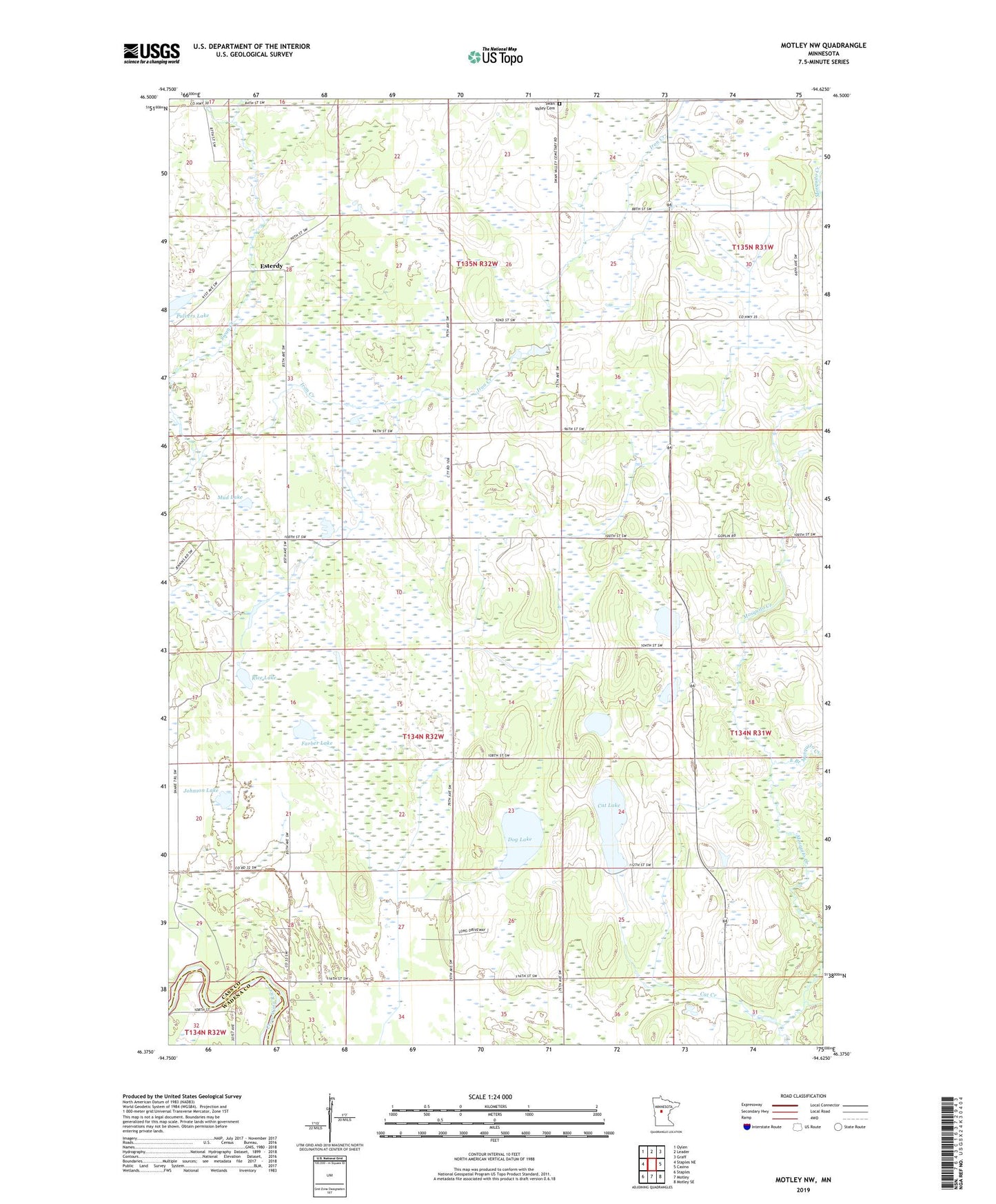
2022 topographic map quadrangle Motley NW in the state of Minnesota. Scale: 1:24000. Based on the newly updated USGS 7.5' US Topo map series, this map is in the following counties: Cass, Wadena. The map contains contour data, water features, and other items you are used to seeing on USGS maps, but also has updated roads and other features. This is the next generation of topographic maps. Printed on high-quality waterproof paper with UV fade-resistant inks.
Quads adjacent to this one:
West: Staples NE
Northwest: Oylen
North: Leader
Northeast: Graff
East: Casino
Southeast: Motley SE
South: Motley
Southwest: Staples
This map covers the same area as the classic USGS quad with code o46094d6.
Contains the following named places: Cat Creek, Cat Lake, Dog Lake, East Branch Mosquito Creek, Esterdy, Esterdy Post Office, Farber Lake, Gladiola Post Office, Iron Creek, Johnson Lake, Meadow Brook School, Mud Lake, Pulvers Lake, Rice Lake, Swan Valley Cemetery, Township of Becker, Township of Byron, ZIP Code: 56466