MyTopo
Herman NW Minnesota US Topo Map
Couldn't load pickup availability
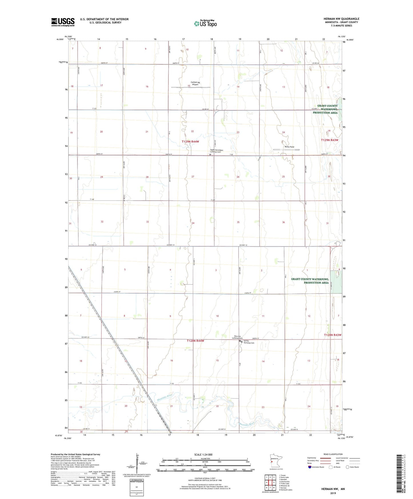
2022 topographic map quadrangle Herman NW in the state of Minnesota. Scale: 1:24000. Based on the newly updated USGS 7.5' US Topo map series, this map is in the following counties: Grant. The map contains contour data, water features, and other items you are used to seeing on USGS maps, but also has updated roads and other features. This is the next generation of topographic maps. Printed on high-quality waterproof paper with UV fade-resistant inks.
Quads adjacent to this one:
West: Charlesville
Northwest: Tintah
North: Stony Lake
Northeast: Wendell
East: Trisko Lake
Southeast: Niemackl Lakes
South: Herman
Southwest: Wheaton SE
This map covers the same area as the classic USGS quad with code o45096h2.
Contains the following named places: Carlson Ag Airport, Gorton Township Cemetery, Judicial Ditch Number Fourteen, Norcross Lutheran Cemetery, Ricks Field, School Number 18, School Number 27, School Number 40, School Number 50, School Number 65, School Number 66, Sigdal Norwegian Lutheran Cemetery, Township of Gorton, Township of North Ottawa, ZIP Code: 56274