
MyTopo
Ojibway Lake Minnesota US Topo Map
Couldn't load pickup availability
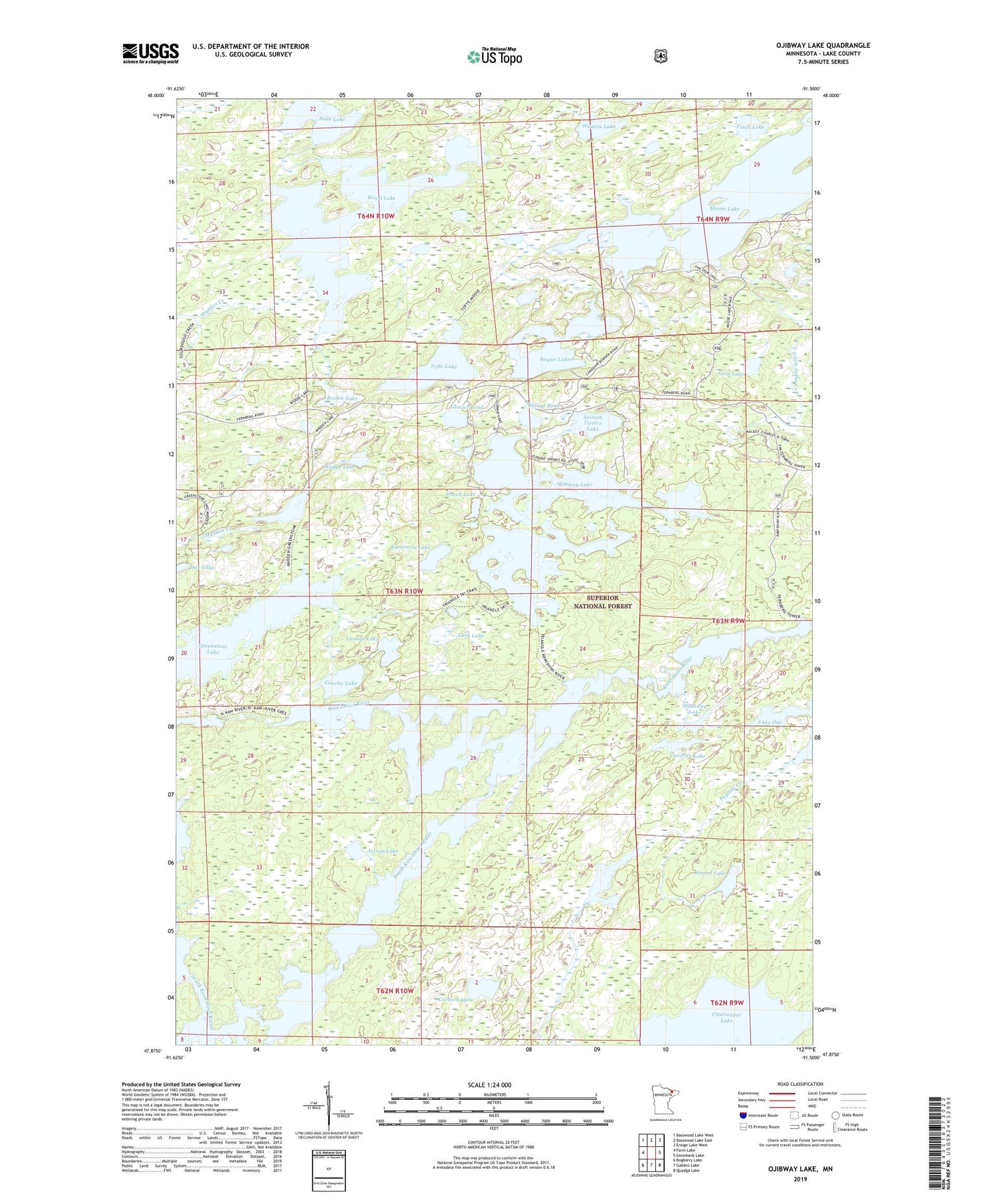
2019 topographic map quadrangle Ojibway Lake in the state of Minnesota. Scale: 1:24000. Based on the newly updated USGS 7.5' US Topo map series, this map is in the following counties: Lake. The map contains contour data, water features, and other items you are used to seeing on USGS maps, but also has updated roads and other features. This is the next generation of topographic maps. Printed on high-quality waterproof paper with UV fade-resistant inks.
Quads adjacent to this one:
West: Farm Lake
Northwest: Basswood Lake West
North: Basswood Lake East
Northeast: Ensign Lake West
East: Snowbank Lake
Southeast: Quadga Lake
South: Gabbro Lake
Southwest: Bogberry Lake
Contains the following named places: Astray Lake, Carefree Lake, Clearwater Lake, Conchu Lake, Cortes Lake, Dan Lake, Finch Lake, Gem Lake, Glacier Pond, Greenstone Lake, Hula Lake, Jasper Creek, Jasper Lake, Jewell Lake, Kamimela Lake, Lark Lake, Madden Creek, Madden Lake, Moose Lake, Ojibway Lake, Pagami Creek, Pagami Lake, Plukesley Lake, Refuge Pond, Rookie Lake, Section Twelve Lake, Tofte Lake, Triangle Lake, Uncle Judas Creek, Upper Uranus Lake, Uranus Lake, Weasel Lake, Wedge Lake, Witness Lake, Wood Lake


