MyTopo
Ostrander Minnesota US Topo Map
Couldn't load pickup availability
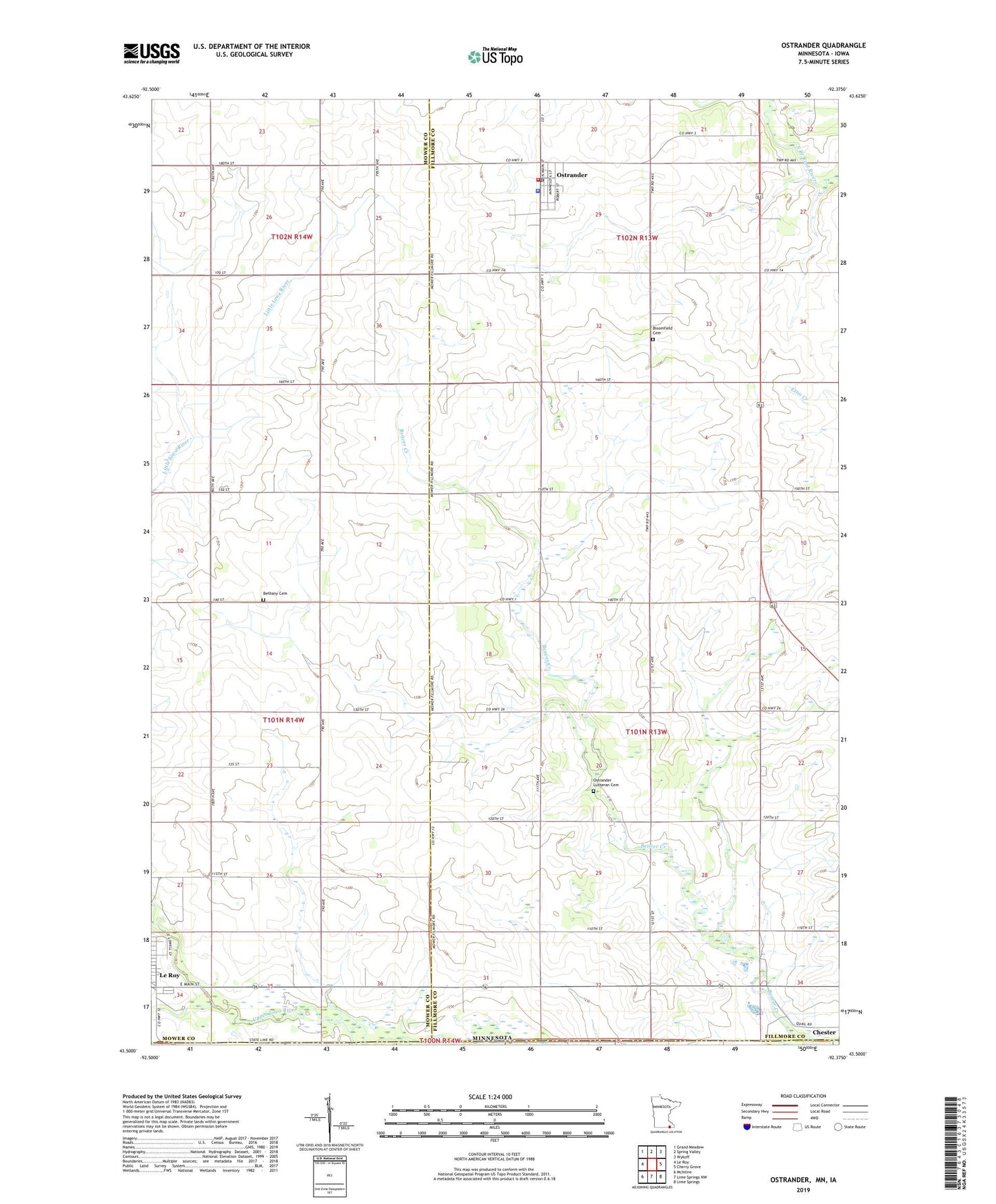
2022 topographic map quadrangle Ostrander in the state of Minnesota. Scale: 1:24000. Based on the newly updated USGS 7.5' US Topo map series, this map is in the following counties: Fillmore, Mower, Howard. The map contains contour data, water features, and other items you are used to seeing on USGS maps, but also has updated roads and other features. This is the next generation of topographic maps. Printed on high-quality waterproof paper with UV fade-resistant inks.
Quads adjacent to this one:
West: Le Roy
Northwest: Grand Meadow
North: Spring Valley
Northeast: Wykoff
East: Cherry Grove
Southeast: Lime Springs
South: Lime Springs NW
Southwest: McIntire
This map covers the same area as the classic USGS quad with code o43092e4.
Contains the following named places: Beaver Creek, Bethany Cemetery, Bloomfield Cemetery, City of Ostrander, KROC-FM (Rochester), KTTC-TV (Rochester), Le Roy Clinic, Ostrander, Ostrander Alternative School, Ostrander Fire Department, Ostrander Lutheran Cemetery, Ostrander Mobile Home Park, Ostrander Nursing Home, Ostrander Police Department, Ostrander Post Office, Root River Country Club, Township of Beaver, Trinity Lutheran Church, ZIP Codes: 55951, 55961