
MyTopo
Pillager Minnesota US Topo Map
Couldn't load pickup availability
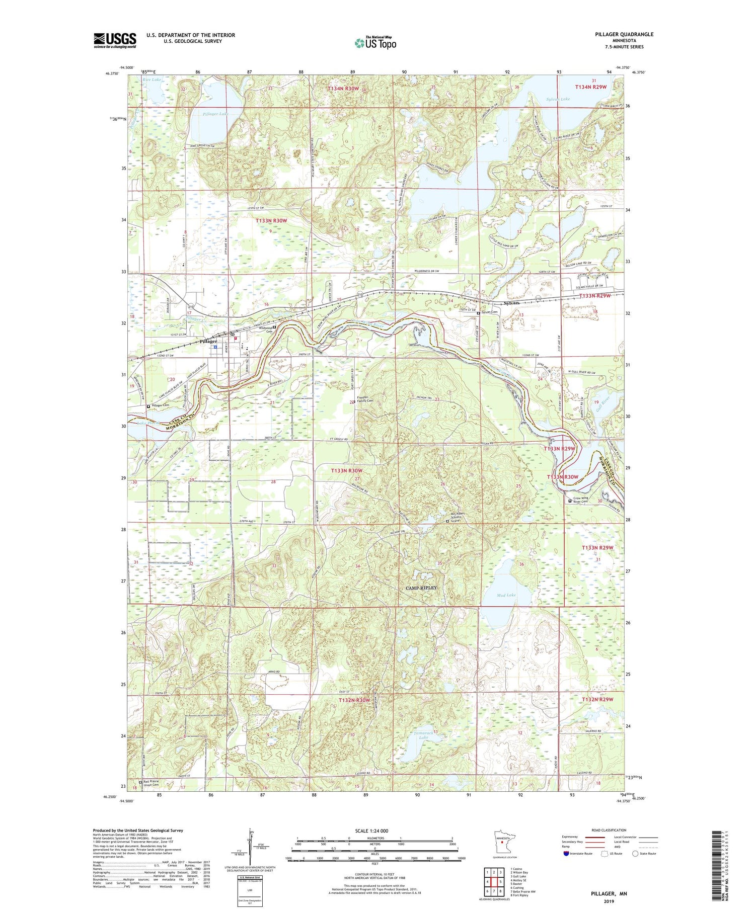
2019 topographic map quadrangle Pillager in the state of Minnesota. Scale: 1:24000. Based on the newly updated USGS 7.5' US Topo map series, this map is in the following counties: Morrison, Cass. The map contains contour data, water features, and other items you are used to seeing on USGS maps, but also has updated roads and other features. This is the next generation of topographic maps. Printed on high-quality waterproof paper with UV fade-resistant inks.
Quads adjacent to this one:
West: Motley SE
Northwest: Casino
North: Wilson Bay
Northeast: Gull Lake
East: Baxter
Southeast: Fort Ripley
South: Belle Prairie NW
Southwest: Cushing
Contains the following named places: City of Pillager, Crow Wing River Cemetery, Crow Wing River Dam, First Baptist Church, First Lutheran Church, Franzen Family Cemetery, Franzon School, Gilgal Church, Gull River, Little Red Sand Lake, Mrs Albert Schultz Grave, Mud Lake, Peaks Charter School, Pillager, Pillager Area Fire and Rescue Station 1, Pillager Assemblies of God Church, Pillager Cemetery, Pillager City Police Department, Pillager Creek, Pillager Dam, Pillager Elementary School, Pillager Lake, Pillager Post Office, Rail Prairie Union Cemetery, Rice Lake, School Number 107, Sylvan, Sylvan Cemetery, Sylvan Dam, Sylvan Lake, Sylvan Post Office, Tamarack Lake, Township of Rosing, Township of Sylvan, Wildwood Cemetery, ZIP Code: 56473


