MyTopo
Wilson Bay Minnesota US Topo Map
Couldn't load pickup availability
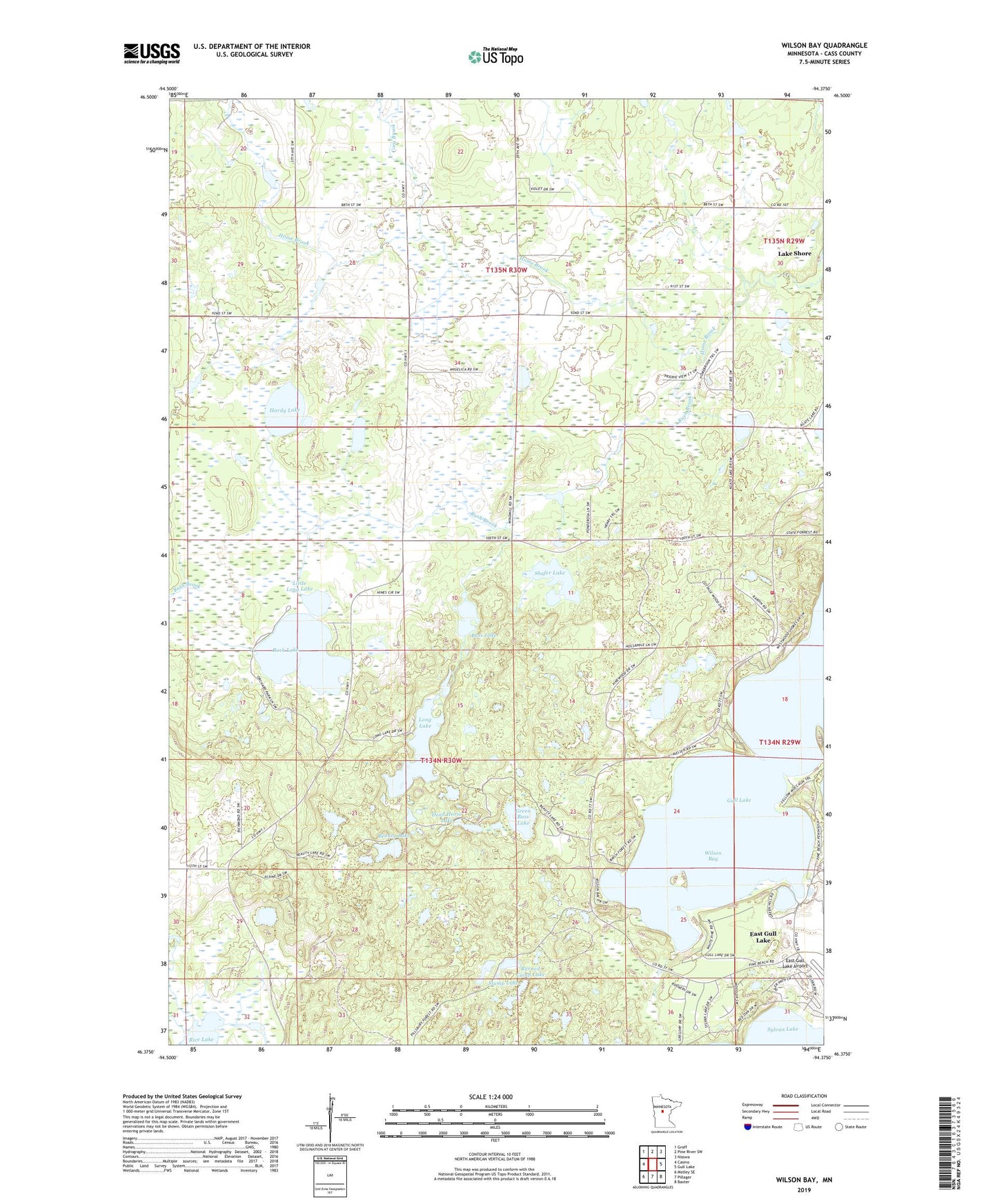
2022 topographic map quadrangle Wilson Bay in the state of Minnesota. Scale: 1:24000. Based on the newly updated USGS 7.5' US Topo map series, this map is in the following counties: Cass. The map contains contour data, water features, and other items you are used to seeing on USGS maps, but also has updated roads and other features. This is the next generation of topographic maps. Printed on high-quality waterproof paper with UV fade-resistant inks.
Quads adjacent to this one:
West: Casino
Northwest: Graff
North: Pine River SW
Northeast: Nisswa
East: Gull Lake
Southeast: Baxter
South: Pillager
Southwest: Motley SE
This map covers the same area as the classic USGS quad with code o46094d4.
Contains the following named places: Bass Lake, Beauty Lake, Burned Camp Lake, Cory Brook, Dead Horse Lake, Duffney Lake, Green Bass Lake, Gull Lake Lookout Tower, Hardy Lake, KAWB-TV (Brainerd), KBPR-FM (Brainerd), Little Long Lake, Long Lake, Madden's Pine Beach East Golf Course, Madden's Pine Beach West Golf Course, Madden's Social Nine Golf Course, Pillager Area Fire and Rescue Station 2, Pillsbury State Forest, Rock Lake, Rock Lake Campground, Rush Brook, Rush Brook Post Office, Saint Thomas of the Pines Church, Shafer Lake, Stump Lake, Township of Fairview, Wilson Bay, WJJY-FM (Brainerd)