MyTopo
Sauk Lake Minnesota US Topo Map
Couldn't load pickup availability
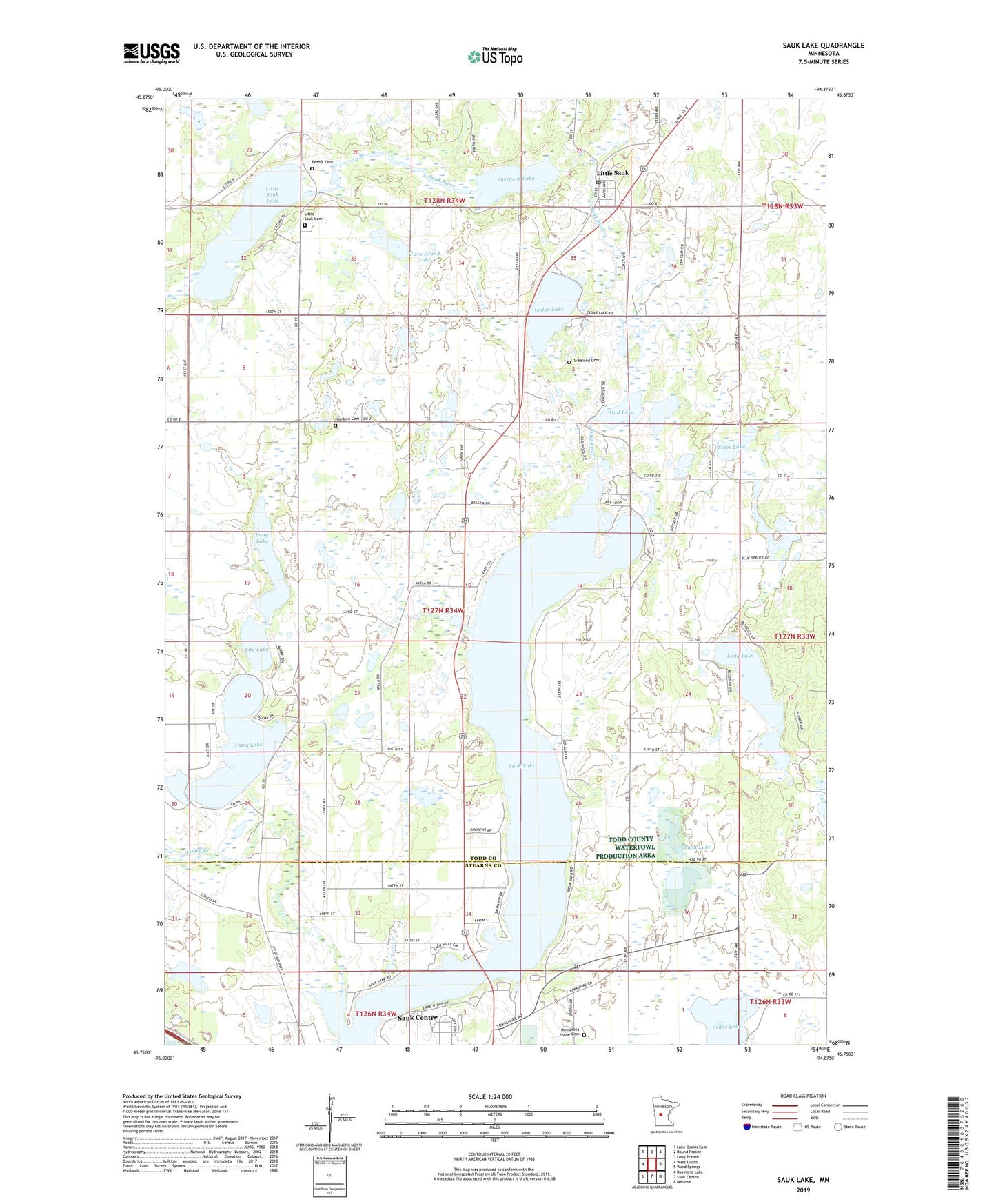
2022 topographic map quadrangle Sauk Lake in the state of Minnesota. Scale: 1:24000. Based on the newly updated USGS 7.5' US Topo map series, this map is in the following counties: Todd, Stearns. The map contains contour data, water features, and other items you are used to seeing on USGS maps, but also has updated roads and other features. This is the next generation of topographic maps. Printed on high-quality waterproof paper with UV fade-resistant inks.
Quads adjacent to this one:
West: West Union
Northwest: Lake Osakis East
North: Round Prairie
Northeast: Long Prairie
East: Ward Springs
Southeast: Melrose
South: Sauk Centre
Southwest: Raymond Lake
This map covers the same area as the classic USGS quad with code o45094g8.
Contains the following named places: Ashley Creek, Berscheid Structure Dam, Bethel Church, Bethel Lutheran Cemetery, Big Sauk Lake Mobile Home Park, Cedar Lake, Cedar Lake Wayside Park, Deer Lake, Fairy Lake, H Groschel Pond Dam, Juergens Lake, Kandota Cemetery, Lily Lake, Lions Park, Little Sauk, Little Sauk Cemetery, Little Sauk Church, Little Sauk Lake, Little Sauk Post Office, Long Lake, Minnesota Home Cemetery, Minnesota Home School, Mud Lake, Sauk Lake, Sauk Lake Wayside Park, Saukinac Campground, School Number 2281, School Number 2300, Spier Lake, Svealund Cemetery, Township of Kandota, Twin Island Lake, Twin Lake