MyTopo
Rush Lake Minnesota US Topo Map
Couldn't load pickup availability
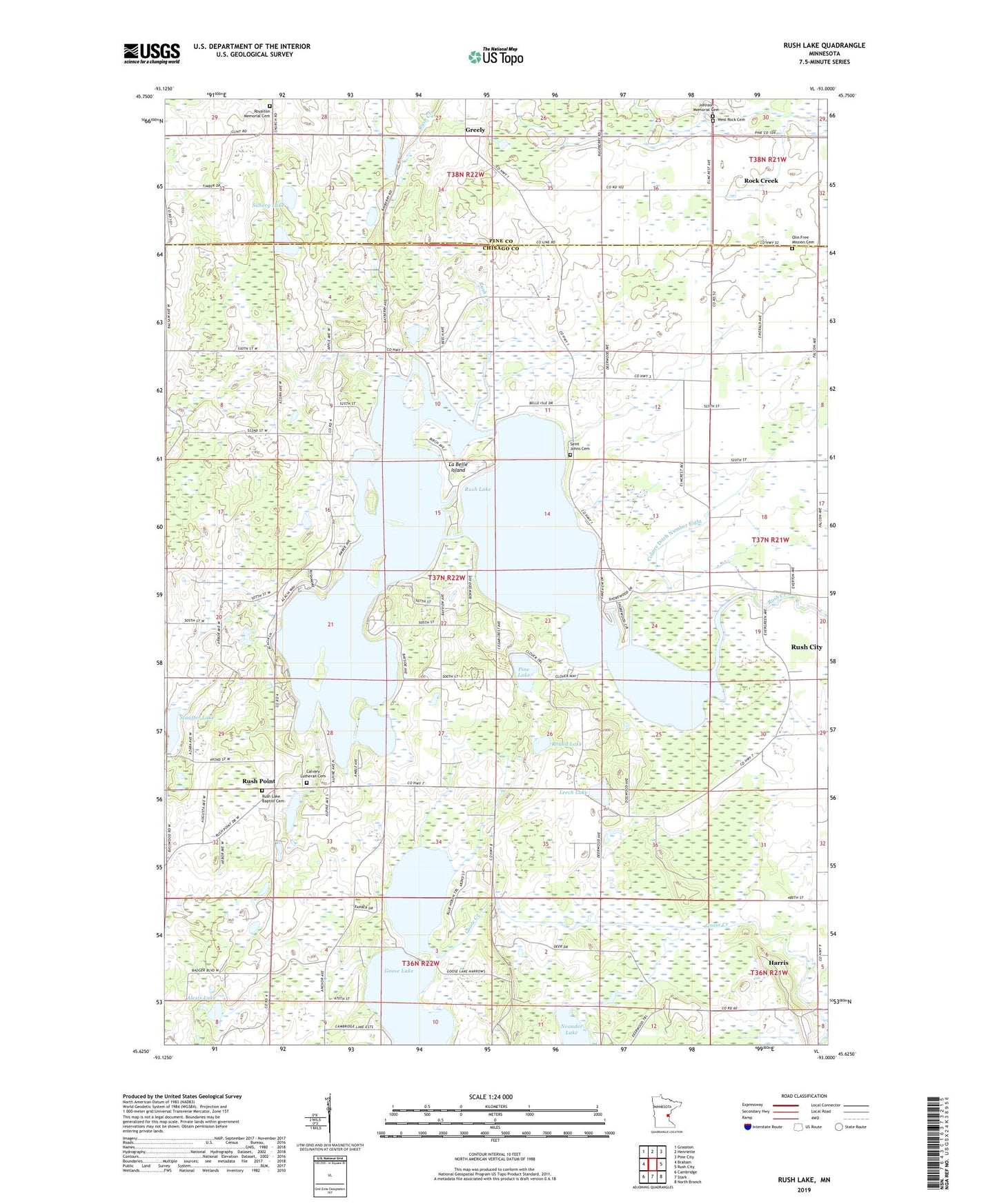
2022 topographic map quadrangle Rush Lake in the state of Minnesota. Scale: 1:24000. Based on the newly updated USGS 7.5' US Topo map series, this map is in the following counties: Chisago, Pine. The map contains contour data, water features, and other items you are used to seeing on USGS maps, but also has updated roads and other features. This is the next generation of topographic maps. Printed on high-quality waterproof paper with UV fade-resistant inks.
Quads adjacent to this one:
West: Braham
Northwest: Grasston
North: Henriette
Northeast: Pine City
East: Rush City
Southeast: North Branch
South: Stark
Southwest: Cambridge
This map covers the same area as the classic USGS quad with code o45093f1.
Contains the following named places: Alexis Lake, Calvary Church, Calvary Lutheran Cemetery, County Ditch Number Eight, Free Mission Cemetery, Free Mission Church, Goose Lake, Greely, Greely Church, Johnson Memorial Cemetery, La Belle Island, Leech Lake, Neander Lake, Pine Lake, Round Lake, Royalton Memorial Cemetery, Rush Lake, Rush Lake Baptist Cemetery, Rush Lake Church, Rush Lake Resort and Campgrounds, Rush Point, Rushmore Campgrounds, Rushpoint Post Office, Saint Johns Cemetery, Silberg Lake, South Bay RV Park, Stauffer Lake, Township of Nessel, West Rock Cemetery