MyTopo
Arendahl Minnesota US Topo Map
Couldn't load pickup availability
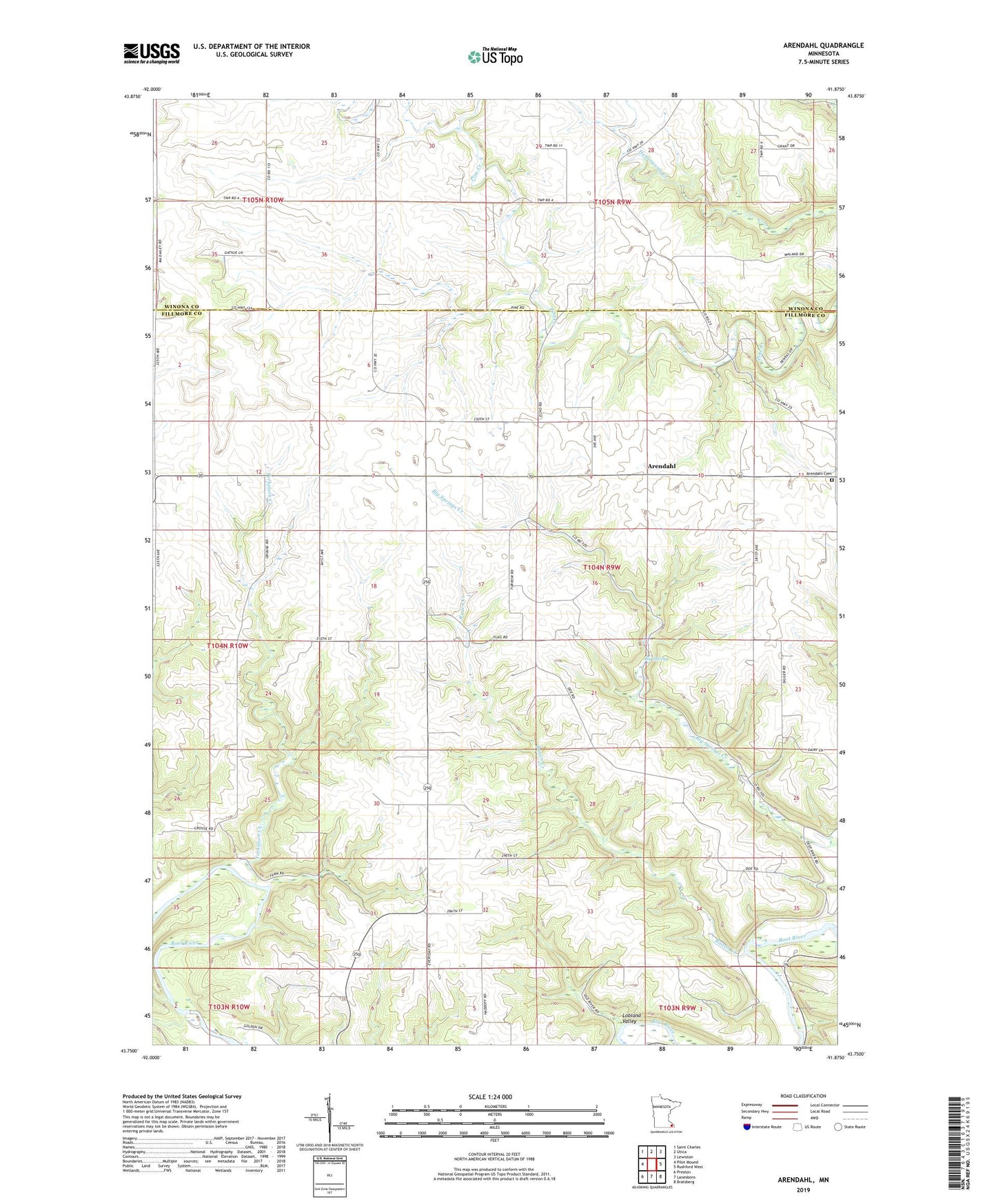
2022 topographic map quadrangle Arendahl in the state of Minnesota. Scale: 1:24000. Based on the newly updated USGS 7.5' US Topo map series, this map is in the following counties: Fillmore, Winona. The map contains contour data, water features, and other items you are used to seeing on USGS maps, but also has updated roads and other features. This is the next generation of topographic maps. Printed on high-quality waterproof paper with UV fade-resistant inks.
Quads adjacent to this one:
West: Pilot Mound
Northwest: Saint Charles
North: Utica
Northeast: Lewiston
East: Rushford West
Southeast: Bratsberg
South: Lanesboro
Southwest: Preston
This map covers the same area as the classic USGS quad with code o43091g8.
Contains the following named places: Arendahl, Arendahl Cemetery, Arendahl Lutheran Church, Arendahl Post Office, Big Springs, Hatlevig-Boyum Group Dam, Lobland Valley, North Prairie Church, Raaen Creek, Torkelson Creek, Township of Arendahl