MyTopo
Saint Clair Minnesota US Topo Map
Couldn't load pickup availability
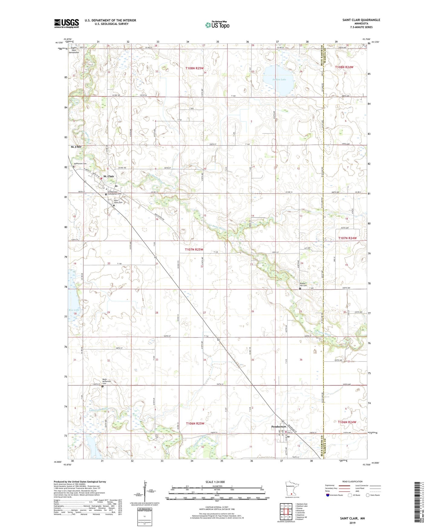
2019 topographic map quadrangle Saint Clair in the state of Minnesota. Scale: 1:24000. Based on the newly updated USGS 7.5' US Topo map series, this map is in the following counties: Blue Earth, Waseca. The map contains contour data, water features, and other items you are used to seeing on USGS maps, but also has updated roads and other features. This is the next generation of topographic maps. Printed on high-quality waterproof paper with UV fade-resistant inks.
Quads adjacent to this one:
West: Beauford
Northwest: Mankato East
North: Madison Lake
Northeast: Elysian
East: Janesville
Southeast: Waldorf
South: Mapleton NE
Southwest: Mapleton
Contains the following named places: Bunker Hill Cemetery, City of Pemberton, City of Saint Clair, County Ditch Number Eightythree, County Ditch Number One, County Ditch Number Twentysix, Eagles Nest Aerodrome, Hoppe Mobile Home Park, Immaculate Conception Cemetery, Immaculate Conception Church, Indian Lake, McPherson Cemetery, Medo-McPherson Cemetery, Pemberton, Pemberton City Hall, Pemberton Post Office, Pemberton Volunteer Fire Department, Saint Clair, Saint Clair Post Office, Saint Clair School, Saint Clair Volunteer Fire Department, Saint Johns Cemetery, Saint John's Evangelical Lutheran Church, Township of McPherson, Winnebago Agency 1846-1855 Historical Marker, Zion United Methodist Church, ZIP Codes: 56078, 56080