MyTopo
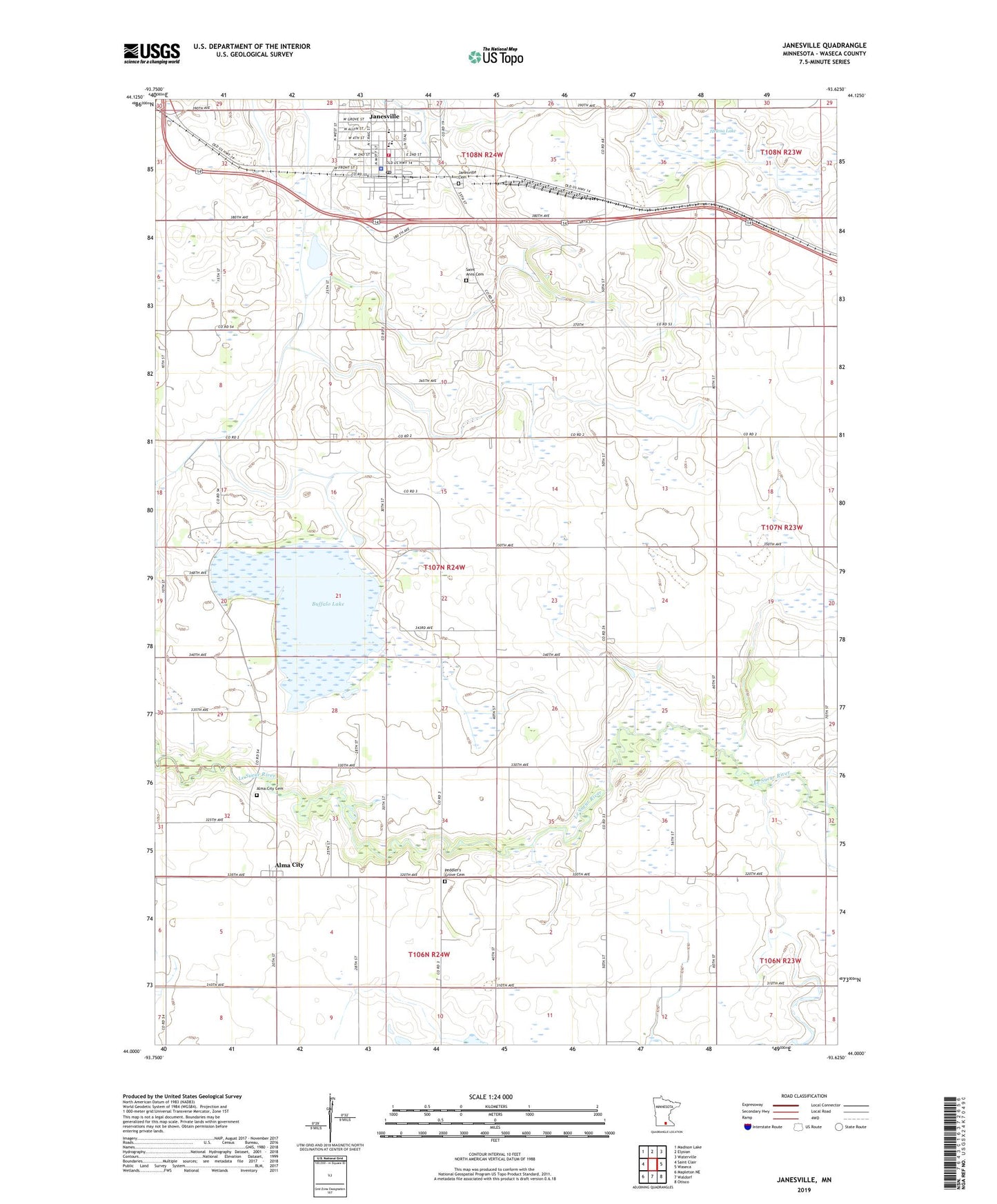
Janesville Minnesota US Topo Map
Couldn't load pickup availability
2022 topographic map quadrangle Janesville in the state of Minnesota. Scale: 1:24000. Based on the newly updated USGS 7.5' US Topo map series, this map is in the following counties: Waseca. The map contains contour data, water features, and other items you are used to seeing on USGS maps, but also has updated roads and other features. This is the next generation of topographic maps. Printed on high-quality waterproof paper with UV fade-resistant inks.
Quads adjacent to this one:
West: Saint Clair
Northwest: Madison Lake
North: Elysian
Northeast: Waterville
East: Waseca
Southeast: Otisco
South: Waldorf
Southwest: Mapleton NE
This map covers the same area as the classic USGS quad with code o44093a6.
Contains the following named places: Alma City, Alma City Cemetery, Alma City Post Office, Buffalo Lake, Buffalo Lake Dam, City of Janesville, County Ditch Number Nineteen, County Ditch Number Six, County Ditch Number Ten, County Ditch Number Three, County Ditch Number Twentyeight, County Ditch Number Twentynine, Faith Lutheran Church, Helena Lake, Janesville, Janesville Cemetery, Janesville Clinic, Janesville Elementary School, Janesville Fire Department, Janesville Nursing Home, Janesville Police Department, Janesville Post Office, Janesville Public Library, Janesville United Methodist Church, North Street Park, Peddler's Grove Cemetery, Saint Anns Cemetery, Saint Ann's Parish, Township of Alton, Trinity Lutheran Church, Trinity Lutheran School, Veterans Memorial Park, ZIP Code: 56048