MyTopo
Sioux Pine Island Minnesota US Topo Map
Couldn't load pickup availability
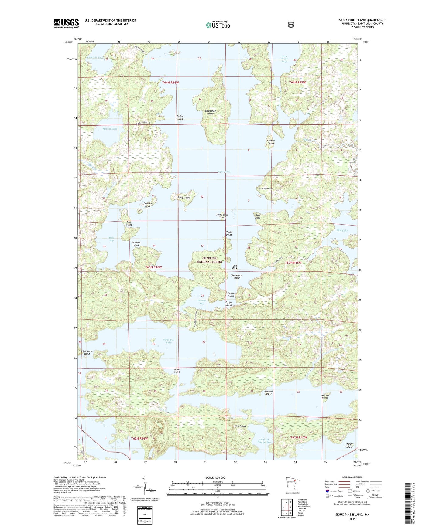
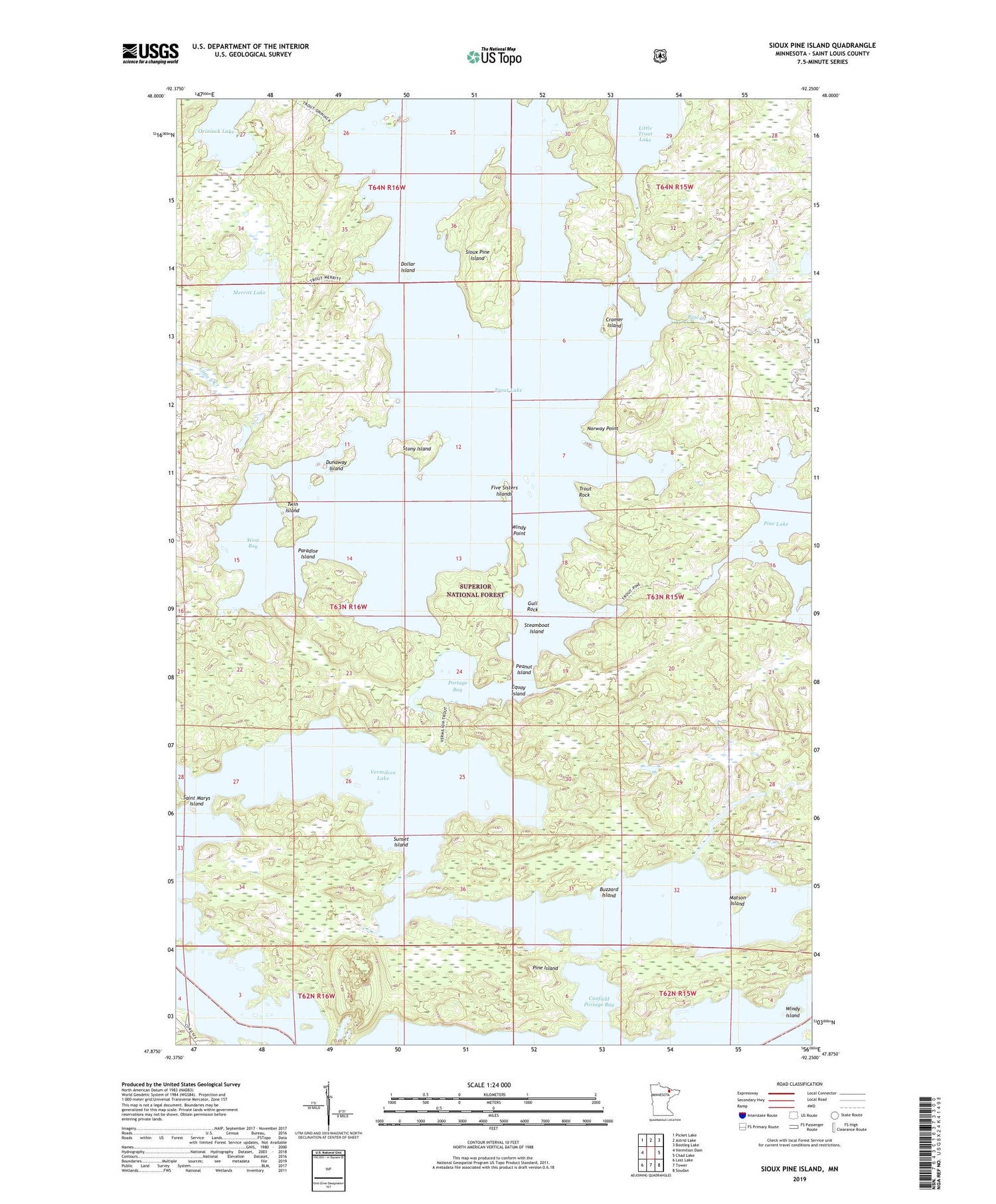
2019 topographic map quadrangle Sioux Pine Island in the state of Minnesota. Scale: 1:24000. Based on the newly updated USGS 7.5' US Topo map series, this map is in the following counties: St. Louis. The map contains contour data, water features, and other items you are used to seeing on USGS maps, but also has updated roads and other features. This is the next generation of topographic maps. Printed on high-quality waterproof paper with UV fade-resistant inks.
Quads adjacent to this one:
West: Vermilion Dam
Northwest: Picket Lake
North: Astrid Lake
Northeast: Bootleg Lake
East: Chad Lake
Southeast: Soudan
South: Tower
Southwest: Lost Lake
Contains the following named places: Arrowhead Point, Bear Creek, Buzzard Island, Canfield Portage, Canfield Portage Bay, Cramer Island, Dollar Island, Dunaway Island, Equay Island, Five Sisters Islands, Gull Rock, Little Trout Lake, Matson Island, Merritt Lake, Norway Point, Paradise Island, Peanut Island, Pine Creek, Pine Island, Portage Bay, Saint Marys Island, Sioux Pine Island, Steamboat Island, Stony Island, Sunset Island, Trout Lake, Trout Rock, Twin Island, West Bay, Windy Island, Windy Point, ZIP Code: 55790